 |
| The headwaters of Church Creek |
I think the last time I hiked with Phil was almost a year
ago. Phil likes to explore off trail in
the high country around Mount Tebo and Church Creek and the Wynoochee . I love that area too, there is no place else
just like it.
The old growth forest
there is unique, but it was all slated for logging, if logging had continued
unchecked under the 100 year sustained yield Shelton unit, this area would have been that last area to be razed. Luckily this area was saved just before Simpson could cut down every last speck of old growth.
Logging roads were built, they clearly intended to log it all, but they got stopped just in time.
 |
| decommissioned road |
This hike took us down one of those roads. The road was built and then a tiny bit of
logging took place and then the logging was stopped. Later the road was decommissioned. Decommissioned roads are really difficult to
hike down, they are all torn up and covered with rocks and weeds. If only they would have left a little path
for hikers and cyclists when they destroyed the road. Better yet, if
only they had left these roads alone, nature would have reclaimed them in a much
gentler way and they would be much more fun to hike on.
Anyway, the goal was to reach a sekrit peat bog that Phil
used to drive to back before everything went to hell. This was a place that Phil loved to visit,
but the last time he tried to visit it he found that the road was in the
process of being torn up and he thought he would never be able to see it again.
Then Phil met me and I showed him that with a whole lot of blood, sweat and tears these destroyed
roads could be hiked down, so now Phil is a hiker. The last time Phil got to visit his favorite
bog was in 1995.
 After stopping to repair a flat tire we drove to the Church Creek trail. The Church Creek trail was
mostly forgotten about after it had been bisected by logging. Then the Mountaineers
re-opened it about ten years ago
and they continue to maintain it.
After stopping to repair a flat tire we drove to the Church Creek trail. The Church Creek trail was
mostly forgotten about after it had been bisected by logging. Then the Mountaineers
re-opened it about ten years ago
and they continue to maintain it.
THANK YOU mountaineers!
This trail originally started at the Church
Creek Shelter on the Skokomish River and then made its way over the divide to
Satsop Lakes and then I think, all the way to the Wynoochee River. Unfortunately logging destroyed about five
miles of the trail, so it is now divided up onto two separate trails, the
Church Creek trail and the Church Creek Shelter trail.
We gained about 1,000 feet on the Church Creek trail to reach the point
where it was routed along an old never used logging road. Where the trail diverges from the logging
road and goes back into the forest is where we left the trail and continued on the
decommissioned logging road instead.
The road was a mess to hike on, but not quite as messed up
as say the old road up to Prospect Ridge or the lower part of the 400 road that
goes along Brown Creek. But still, it’s
tough going, it's hot and rough and slanted and rocky and decorated with downed trees and logs. We went up the road until it topped out at
3,500 feet and we had a peek-a-boo view of the Wynoochee River.
Then we realized we had gone to high, the road was not where
it was supposed to be on the maps. We had made a wrong turn at an intersection of what we thought was a loop and we ended up above the bog and it was not
clear how we were going to get down to it.
Eventually we found a route down that was not too bad. We had to negotiate a steep slope, boulders,
downed logs and snow to get down to the bog.
 |
| Working our way down to the bog from the road |
 |
| Working our way down to the bog from the road |
The bog was very pretty and it was a bryologist’s
heaven. There was peat moss and all
kinds of liverworts to look at there, plus frogs and frog's eggs. Such a beautiful spot; I would like to go back and camp there and
make a day of exploring the flora there before the mosquitos hatch.
 |
| One of the dicey ravines dug into the old roadbed |
We made it across the gorges without dying and eventually we
made it back to the spot where the trail follows the road, but before we got
there I found a bunch of Black Fruited Stink moss (Tetraplodon mnoides). This
is a very rare moss in Washington State and it is ranked S1. No doubt that tearing up all the roads
destroyed a bunch of this moss.
 |
| Tetraplodon mnoides |
By the time we got back down to the Church Creek trail it was dark
enough for me to want to turn on my headlamp.
Phil did not have a headlamp, so we had to go kind of slow, but at the
same time we wanted to go kind of fast so we could make it out of there before
it was too dark for Phil to see at all!
It was good and dark by the time we got back to the Jeep,
but there was a full moon. The drive
back out to the pavement was slower because we were running on a donut tire and
the Jeep does not have high beams.
I
finally made it home at 11pm. Luckily I
had warned my husband that I might not be home before dark, so he was not worried
about me.
This was a somewhat short, but very rough hike due to
the state of the roads, so I am very tired today. I am also sunburned. Those old torn up roads are baking hot and
fully exposed due to being widened by decommissioning, they are also havens for
ticks and invasive weeds.
Sooo these hikes
are not particularly fun, but if you want to see some of the really kewl stuff
up high in the National Forest and have it all to yourself, it’s a price you have to pay. I'll be back.
I believe that the route we took back down is the route to
climb Church Mountain. It used to only
be a 5 miles one way hike to climb Church Mountain. I think it’s about 10 miles one way now that
the road has been savagely destroyed, so it's no longer a dayhike for most people.
7.5 miles with 1,700 feet elevation gain 3,200 feet total
elevation gain according to Google earth
 |
| track in Google earth |
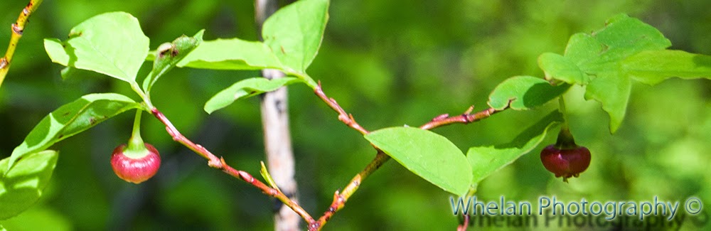 |
| Blueberries |
 |
| A panorama of savage logging practices and ruined roads |
 |
On top of the divide between Wynoochee and Skokomish
We saw the Wynoochee river from up there |
 |
| A funny looking conk |


No comments:
Post a Comment