Sunday, May 27, 2012

Cushman hill loop brown creek road destroyed


Glad to be somewhere less crowded than Ellinor on Memorial Day Weekend


Started hiking at about 11am, decided to do the loop clock-wise this time and started out on a bike.  Expected to be able to bike most of the way but got a very rude surprise.  FS 400 that runs next to Brown Creek has been obliterated, they call it decommissioning and it must make a ton of money for whoever does it but it ruins the road for even hiking.  I wish they would turn these old roads into trails instead of “decommissioning them.   This was the same thing they did to the road up Prospect peak and I had just done 13 miles of this type of “trail” tread on Wednesday.  It did not bother me too much but it ruined the beauty of the road hike.  I remember the wonderful serene feeling I got the last time I was on this road.
Another road ruined for hiking
The road before it was destoroyed for hiking, picture from 2010


I had to ditch my bike right at the start of FS-400 because you just can’t bike a decommissioned road.   Near the end of FS400 I cut up to a new road that they seemed to have built just for the sake of decommissioning the old road... How much sense does that make?  None, it’s all about money.  
From that road I was able to access the Green Diamond aka Simpson clear cut.  Green Diamond aka Simpson is a multi-national logging corporation as has destroyed almost the entire south flank the Olympics.  But now they are restricted to cutting on their own land, they have been kicked out of our national forest after basically being giving all those trees for free.  They built the roads too but they subtracted road building costs from what they paid for the timber and they were the only bidders so they were able to practically steal all the lumber.

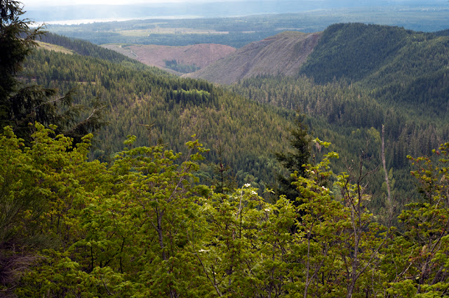
There are some nice views in the Simpson clear cut but it’s also hot and dry in a clear cut and they used fertilizers and herbicides in the clear cuts so I carried water with me from Brown Creek rather than just fill up as I got like I normally do.  My friend made the section worse by stopping and scrolling on his phone in the middle of the road.

The view from the clear cut was not as nice as I remember.  It was a long day.  In all I hiked 10 miles and biked 2 miles.  I made several wrong turns and they added a mile to this trip. 
I doubt I will ever do this loop again now that the brown creek road has been destroyed.

12 miles with 1,500 feet elevation gain


Friday, May 25, 2012

Bryophyte from Prospector's Ridge Ptilidium californicum


 Ptilidium californicum
This was good to find.. only one specimin is known in the state and it was found in 1927 http://www.tropicos.org/Name/35185905?tab=specimens

I'm not surprised that it's Basionym is: Lepidozia californica Austin       

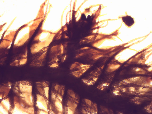
This looks to be a Lepidozia, but it's large for a reptans and it's brownish rather than bright green. This was at 3,800 feet growing on the top of the base of a pistol butted Mountain Hemlock. Leaf cells are about 15um, leaves are about 1mm long depending on where you measure. Stem is about 2.5mm wide. Spores are 25-30um, round and worty.


Elators and spores

microscopic movie leaf detail


Thursday, May 24, 2012

Prospector's Ridge

Prospector’s ridge

I started my hike at 10:14 AM.  I had hoped that the gate being open would shave a few miles off my route but it only shaved off a mile.  It did however shave off a steep hill and I was happy to be driving up that hill in my car.  I expected snow at my destination at 3,800 feet elevation but it did not look like I would need snowshoes so I left them in my car; that was a good call.

I had a smaller peak in mind that would save me a few miles but I passed up that peak and went straight for the top.  At the lower part of the trail everything was green and all kinds of interesting deciduous tree were blossoming.  I saw slide / vine maple, plums, dogwoods and more.  I saw moss that glowed yellow.  I’m not sure what it was, maybe homalothecium, except it was not as soft and seemed to be semi aquatic. 
The road has been decommissioned and is in terrible shape for hiking with huge water bars every 1/10th of a mile.  The water bars are very deep and covered in hay and big sharp rocks.  My knee paid for this.
I hiked up in shorts, gaiters and a t-shirt. 
I first hit snow at about 2,800 feet, later at about 3,100 feet I had to trudge through a mile of snow that was across the road at a 45 degree angle.  This was not fun, but the snow was soft and I was able to stay on my feet.  This snow was on a north facing slope and once I went around the corner to a more south facing slope the snow was gone. 
tough walking

Later when I was above 3,000 feet I hit more snow and then I got the surprise of my life.  As I went around a corner I was startled by the sight of a big black bear.  My instincts made me scream and my scream startled the bear, but the bear did not run.  That worried me, bears are supposed to run, but I remembered I had bear spray while I reached for my camera to take some pictures.  I got one picture of the bears face before it ran across the road and scrambled up the hill.  Patches did not seem to see the bear but when we reached the bear tracks in the snow she sniffed them very excitedly and followed them across the road but made no attempt to leave the road or chase the bear.  Patches is a smart dog.
S/he looked a me, I looked at her, I looked at her, s/he looked at me.
She said to me, "I see you ain't got any gun so why don't you run?"

S/he decides to leave when she sees Patches (Patches never saw her)

This bear did not need tennis shoes to run


After I reached the end of the road I bushwhacked up the very steep grade to the top of the ridge that was covered in pipe cleaner moss.  I hit the ridge-top at 2:40.  I sat there on the ridge under the old growth mountain hemlock forest and had a cup of tea and ate my lunch.  It felt good to sit down, but it was cold up there.  I had to put on two extra top layers a hat and gloves.  Patches had dry dogwood for lunch but she refused to eat any of it until it was clear that we were about to leave.

Bushwack to the top

Patches blends in at lunch time

Causeway bridge over Lake Cushman
I spent about 40 minutes at the top and then bushwhacked back down to the road.  After I had gone only about 1/10th of a mile down the road I stripped down to shorts and a t shirt again and I hiked out in those.  The weather was mostly sunny but there was some snow and some rain.  There was never enough rain to make me put my DSRL away though.  I only brought my prime glass today as I knew it would be a long hard hike for me and I had the extra weight of the bear spray already, I did not want to carry a heavy lens too.
As I neared the end of my hike my right knee got really stiff.  I think the pressure exerted by my ankle brace catching my ankle so many times caused some stress for my knee.  My knee does not feel injured, it just feels over used.  I had to limp out and I was glad to see my car.

So glad I made it back down this before my  knee froze

I finished my hike at about 7pm and got home after 8pm.  When I got home I limped out of my car and then went for a short post hike walk to try to limber up and then I had a long hot bath.  I went to bed at about 10:00 and I fell asleep immediately and I did not wake up until 6am.  Today I am sore from head to toe.  Even my hands are sore, but it feels great to be alive.  I took 386 pictures.
13 miles with 2,800 feet elevation gain


Alectoria lichen

This was so big that I thought it belonged to a horse, but I was to learn that bears
do this in the middle of the road and not just the woods

Cutting back down to the snow covered road

Wild Cherry Prunus emarginata

Lichen porn on a Cherry tree

Puma concolor  or cougar or mountain lion shared the road with me again

Mount Ellinor and Washington above the clouds

Beautiful glowing moss, perhaps Homalothecium

More lichen porn

The Brown Creek Valley and the Hood Canal

The Great bend in the Hood Canal

m
Dead mole

Mossy spoon, I wonder if this was mine?

My trail today

Pilophorus acicularis

Pretty green area at the start


Same rainbow, different angle

Rhytidiopsis robusta with sporophytes

A bare area to walk on

Rough skinned newt Taricha granulosa

Two panos

watermelon snow Chlamydomonas nivalis

That's a workout!

Monday, May 21, 2012

Lake Sylvia State Park


They have a really beautiful trail at Lake Sylvia State park.  The trail is well maintained and has lots of new bridges.  There is also a covered bridge in one spot.   I found an abundance of thalloid liverworts there.   2 miles 50 feet elevation gain


Egg shaped spores and coil shaped elators from Pellia

Pellia


Pleurotus ostreatus