Miles feet F per M
Ellinor 2.60 2419.00 930.38
Ellinor 2.60 2419.00 930.38
Walker 4.00 2000.00 500.00
MountWalker 6.00 2000.00 333.33
LowerLena 6.00 1300.00 216.67
Lena 6.00 1300.00 216.67
Rose 6.50 3500.00 538.46
LowerLena/Brothers 8.00 1500.00 187.50
BigCreek 8.00 1500.00 187.50
UpSoFoSkoksup 8.00 1100.00 137.50
NoFoSkok/spike 9.60 848.00 88.33
BigCreekUpper 10.00 2320.00 232.00
Elwatohurricane 10.50 4450.00 423.81
Dose 11.50 1250.00 108.70
Deseret 13.00 3500.00 269.23
Dose 13.30 1300.00 97.74
MarmotPass 14.00 4202.00 300.14
HighDivideLoop 18.80 3500.00 186.17
18 hikes
Average Miles 8.80
Average Elevation Gain 2244.89
Total Miles 158
Total Elevation Gain 40408 Feet
Sunday, December 31, 2006
Thursday, December 28, 2006
Who reads this blog?

I think that the only person who reads this blog is my mother. Please post a comment if you read this blog and you are not my mother.. :)
Wednesday, December 27, 2006
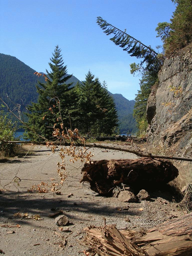
Dosewallips
 Dosewallips, duswa’ylups: The title of a mythical chief who the Transformer changed into a mountain near the head of the river.
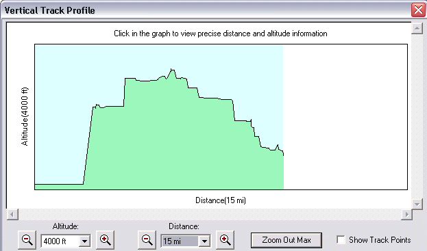
11.5 miles 1,146 gain that's only a 15 on the Hike Difficulty Calculator but it kicked my butt. Maybe it was the ups and downs that did me in or maybe it was trudging along in the snow or maybe I'm a bit ill but I sure was ready for this hike to end by the tenth mile. I drove 1/10 of a mile before I remembered to turn off my track log so the elevation profile goes more then 11.5 miles.
(A local paper says it's 1250 feet in and 220 feet out so I can ad a few extra feet but still that only rates a 16 on the calculator.. hmmm and now it's two days later and I'm still stiff, sore and tired.)
Santa brought me a fancy new GPS and now my elevation charts are nice and smooth like the one above. This was my first hike with my new GPS. My old GPS is an Etrex Legend and it lost the signal on every hike. So far my new GPS has never lost a signal.

I bought myself an old beater Jeep (175,000 miles on it) this month and that enabled me to actually reach the washout. The last time I hiked here I had to stop my car a mile before the washout, that trip report is here.
Armed with a new Jeep and a new GPS I ought to have lots of fun hiking and geocaching in the coming year.
The heater in my Jeep is broken, it keeps blowing fuses and we took it to a mechanic who could not find the problem but charged us $95.00. It probably needs a new blower motor, if I had more money I would get it fixed now but I'm broke after Christmas. It's not a lot of fun driving around without a heater because it's cold and the windows fog up. But if I drive at highway speeds for long enough it warms up a little bit and most of the window fog goes away.
This is a pretty hike in spite of it being just a walk down a closed road. I believe that this road is now a trail and treat it as such. Everyplace that was covered with snow on the road had cougar tracks. In one spot I think an adult and baby cougar had been chasing a rabbit. In other spots the cougars just seemed to be walking along.
The falls are nice to look at but the hill beside them sure it steep and can be seen as the up and down near the middle of the elevation log. The overland trail that avoids the wash out is a bit steep too. That is easier to see at the end of hike where it is not covered up by a label.

Most of the picnic tables at Dosewallips camground were either covered with snow or partly underwater or both. I found one table that someone had tipped up onto it's edge, I pushed it back down and enjoyed a snow free spot to cook and eat lunch. For lunch I had a cup of hot cocoa and fried rice with king boletes, chanterelles and beef.
I did not see anyone else on the trail and the last human foot prints in the snow stopped less then one mile into the hike. This tells me that no one has been down here since it snowed 4 days ago. I found it a bit unnerving to be all alone miles and miles from the trail head with cougar tracks everywhere around me. I was extra alert but kept reminding myself that cougars are everywhere even when I don't see their tracks. But this is the first time I have seen cougar tracks in the snow so there must be more of them here then in my usual hiking spots.
I passed the Lake Constance trail head on the way. I've never been up there and I don't know if I ever will. I think the trip back down would kill my knees. I was surprised to learn that my Dad has been up there. He is not a hiker but he is a fisherman. The Lake Constance Hike would be a whopping 39 on the hike difficulty calculator
Wednesday, December 20, 2006
Lower Lena Lake after the Windstorm
 We set out to hike up to lower Lena Lake on this cold and wet day. Getting to the trail head was a bit of a challenge. We counted about 30 blow downs on the Hamma Hamma road. Each blow down was cleared only enough to open up one lane of the road. Driving to the trail head involved constantly changing lanes to avoid each blow down. I had to run over some rather large piles of branches and it was a bit dicey to run over such things in my little ground hugging station wagon, but I can say that the road is passable in a passenger car. There is some patchy snow near the trail head.
Access to Putvin trail is blocked by downed trees, basically only the Hamma Hamma road is clear, all the side roads going off it are blocked by downed trees.
 The Lower Lena Lake trail is in pretty good shape considering all the recent wind and rain. We counted 21 blow downs between the trail head and lunch rock. Most of the blow downs were small enough to step over. We had to crawl under two of them and walk around some of them. There is a large multiple tree blow down about 1/2 mile before the lake that obliterates 30 feet of the trail. Closer to the trailhead a tree has fallen onto and broken a wooden hand rail.
We encountered patches of melting out snow on the trail 1/4 of a mile from the lake. The lake does not have any ice on it but there is some snow on the surrounding hillsides.
I took my oldest daughter with me because my husband needed to be alone to go Christmas shopping. I like hiking with my daughter but I really look forward to my time alone. I need to get out into the woods and be alone so I can clear my head and have my thoughts to myself.
My husband insisted that he needed to go shopping today and that I was denying him the chance to go shopping by not taking her. So I took her and we had a good time hiking together. She is a great little hiker, she had no trouble completing the 6 miles round trip with 1,250 elevation gain and she has not been hiking since last summer. Today's hike scores a 15 on the hike difficulty calculator. This was a cold and wet hike and we were both running a fever so it seemed even colder then it was.
On the way home we got a rare and special treat, we saw Sea Lions swimming in the Hamma Hamma river. There were several lions and they were surprisingly loud. We no longer have to got to the Oregon Sea Lion Caves to see lions! We watched the lions until we got too cold. We did not really warm up after our hike until we got home. My car's heater does not work the way it should.
When we got home we found that my husband had not done any shopping. He spent the day laying on the couch sick while my 2 year old destroyed the house. She flooded the bathroom destroying everything under the sink and smeared poop all over her room. I have a big mess to clean up now and I'm tired from being ill and from hiking and I have to throw a birthday party in my house tomorrow..... sigh...
Happy Winter Solstice!
Wednesday, December 13, 2006
Upper Big Creek to Over Look
Today I started at the Big Creek Campground and went up the Upper Big Creek Loop trail to the Ellinor connector trail. I turned around just before the Lower Mount Ellinor Trailhead.
My snowshoes were dead weight on this hike, I lugged them all the way up and all the way back. The only snow I encountered was at 1700 feet and was only patchy. There was one fresh blow-down on the trail, I thought it was small enough for me to be able to move but it was not.
There is a very nice over look 3 miles and 1750 up from the Big Creek Campground and this was my turn around point today. The sun came out briefly and the view of Lake Cushman was nice. I brewed a cup of tea at the viewpoint and this combined with doing a shorter then normal hike gave me a nice hikers high that carried me all the way back to the car.
There were two other parties on the trail today.
Today was 6 miles and 1770 gain for a difficulty of 18 on the hike difficulty calculator.
Wednesday, December 6, 2006
Too much Snow so I had to go to Mount Walker
 I set out this morning with the intention of hiking up to Lower Lena Lake and then snowshoeing into the Valley of The Silent Men on the Brothers trail. Things did not go as planned today. There was too much snow for me to drive my car to the trail head. I only made it 1 mile from 101 before I turned around. My car was starting to slide and I had 6-7 more miles of road before the trailhead. The road was getting worse and worse by the mile so I knew there would be more then a foot of snow on the road by the time I reached the trail.
After getting turned back by snow the way to my planned hike at lower lena lake I decided to hike the Duckabush trail. I know that the road out there is plowed all the way to the terror cabin (Interrorem Cabin). I remembered that the trail head is only a couple of miles from the cabin. Well I only made it 1/2 mile beyond the cabin before my car started losing traction and it was just too scary to go on. This was much worse then the
 snow I hit on the way to Lena Lake. I'm sure that the snow closer to Lena Lake would have been just as bad.
I'm a bit disappointed in my cars snow performance. Perhaps it's time for new tires.
I got so close the trail head. If I actually liked the Duckabush trail I might have parked and hiked the 1 1/2 mile to the trail head.
I knew there would be no snow to stop me from getting to Mount Walker since it is right off 101 so I decided to give Mount Walker a try. There was plenty of snow on the Mount Walker trail head but there were lots of cars there. Maybe other people had the same problems getting to the trails this morning.
People were walking up without snowshoes but I put my shoes on about half way from the top. The top was a winter wonderland with 2-3 feet of snow in the drifts and about 1.5 feet of snow on the trail. The sky was clear and I finally got to see the view up top. The only other time I walked to the top of Walker the snow was falling and there was no view. I could see Mount Baker and Mount Buckhorn and I could look down to the town of Quilcene.
I spent about an hour on the summit brewing tea and cooking lunch. I had to melt snow to cook with and my little alcohol stove is not the best for melting snow. The stove went out twice and I almost gave up on having my cuppa on the top. Next time I will bring cooking water up the from my car. Unfortunately there was some horrible loud industrial noise floating up to the summit from the town of Quilcene. The summit was not as peaceful as I had hoped it would be.This morning my legs are sore even though my hike was only 4 miles round trip. With it's 2000 feet of elevation gain in just 2 miles this trail rates a 25 on the hike difficulty calculator.
 I really like the Mount Walker trail, the woods are nice and it's a good little work out. My only complaint is that you can hear the noise from 101 everywhere on the trail and you can hear the noise of Quilcene from the summit. Mount Walker is not a wilderness. In the summer they open up the road to the top and people can drive up the 4 mile road and have a picnic at the viewpoint on the summit.
If one walks up the trail and then down the road one can do a 6 mile round trip walk. I did the road walk down once and my toes got sore. The road walk is 4 miles of the exact same grade with no ups or downs.
You'll have to forgive my usual grammar problems and typo's, I 'm too wiped out from the hike to bother fixing them.

Tuesday, November 21, 2006
Big Creek Camp to Mount Ellinor Upper TH Almost
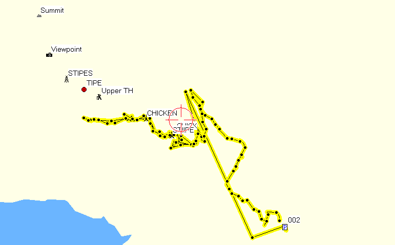
2,320 elevation gain and 10 miles. That's a 19 on the hike difficulty calculator . I'm tired and sore but feel good. It was very good for me to get 6 hours all to myself. Six hours of just me and the trail, trees, rain and snow. I really needed this mental break. It's been quite a while since I've had a good hike and I was starting to get out of shape.
The snow was blowing sideways near the upper trail head and the days are getting shorter so I turned around one quarter of a mile (by air) before the upper trail head.
My track log and elevation chart are not the best because my GPS did not a have a signal much of the time.
Thursday, November 16, 2006
Chanterelles and Hoodsport Wine
 (Click to Enlarge)
Well I finally got some Chanterelles near home. They are soggy as hell but they are not rotten so I'm gonna eat them. Since these were already so soggy I went ahead and washed them off with lots of running water. They are now in the dehydrator. I'll eat them tonight after they have dried down some.
I had to discard several shooms that were starting to rot.
This a new spot for me and I'm excited to have a new spot. These shrooms cost me $25.00 plus gas.. I put my youngest in day care so I could get out in the woods and be alone today. At least I found some mushrooms.
I've been feeling a bit blue the past few weeks and I really needed to get out and do some walking. Finding mushrooms was a big bonus. Maybe this will lift my spirits.
I have discovered a wine that I really like it is raspberry merlot from Hoodsport winery. I better be careful it could become an expensive habit. I finished my first bottle of it about a week ago. Last night I discovered that my local Safeway carries it and it was $3.00 cheaper then the price at the winery. Still at the $9.99 per bottle that I paid for it the price could ad up if I learned to like it too much.
Tuesday, November 7, 2006
King Boletes
 It's been a few weeks since I have been able to go hiking. It's cold and school season. I sure get tired of being sick every fall.
I have been able to go camping every weekend though. Last weekend we went to the coast and picked 15 pounds of King Boletes. We got all but one of the boletes on the first day looking. At the end of the day we found a patch that had as many boletes as we had picked all day. Unfortunately for us an Asian woman who had been clandestinely following us around rushed up to us and picked three of the bigger kings.
We had two nice King Bolete meals at the campground and made up a big Cream of Bolete at home. The rest we dried and our season total is 14 ounces of dried King Bolete.
Our local chanterelle spot should be wet enough to pop now but we were both too sick to go check this afternoon.
We got over 3 inches of rain yesterday and have gotten 9 inches of rain in the last 4 days so it's plenty wet enough!
My camera went in for warranty repair but Cannon lost my invoice and just held on to my camera for a month. It would have sat there forever if I had not called and asked them what the hell was going on. But Cannon seems to be trying to make up for it. They sent my camera back to me by Fed Ex Second day air. I should have it back tomorrow. I wish I could have taken pictures of all our boletes.
Thursday, October 26, 2006
King Boletes and Men on Horseback
We went to the coast and got about 8 pounds of King Boletes!
In the scan we think we have a Tricholoma flavovirens.
Monday, October 16, 2006
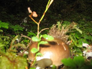
Honey Mushrooms Came to Me

 Honey mushroom growing in my lawn. It has white spores and the cap is viscid when wet. Some stalks have veils. I can not find any wood that it is growing on.
 I got verification that these are Honey Mushrooms from Michael W. Beug whom I "discovered" thanks to his wonderful mycology website at Evergreen University.
Click on the pictures to enlarge them.
Wednesday, October 11, 2006
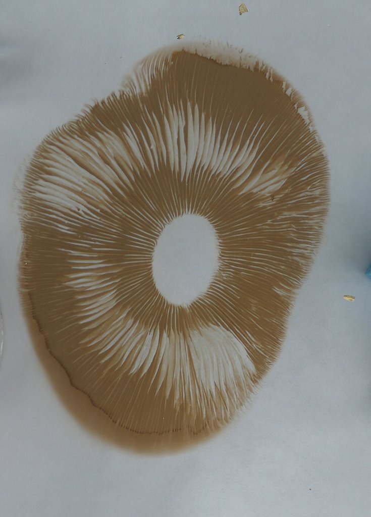
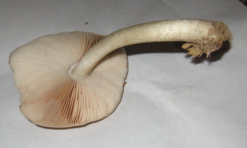
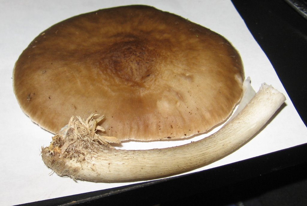
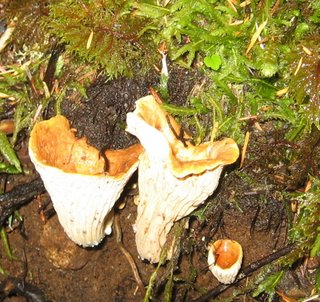
Pretty Mystery Mushroom
Tuesday, October 3, 2006
Mount Ellinor
 Finally got to go hiking again. I felt pretty strong going up Ellinor but a bit weak going down. I normally feel week going up and strong going down. Normally I hike down something about twice as fast as I hike up something.
No views to the West from the top for me today, the clouds chased me up the mountain. I had the summit to myself for about 10 minutes then a friendly manic showed up. He was in a good mood and very talkative but he quieted down and did not bother me at all when I told him I was going to sit and have lunch. Maybe he was only a hyphening.
At one point I passed a woman who was hiking up the trail with a burping and farting and spitting and saying AHHHHH too loudly after a drink of water type of man.
As I passed her she said to me
"You're doing it the right way".
I assume she meant that by hiking solo I was doing it the right way.
No mushrooms, it's just too dry. I "hiked" the .5 mile lower loop of the Hoodsport trail on the way home from Ellinor but it's too dry there too.
My digital camera is broken and going in for repair so I have no pictures for this hike. It's a Cannon Powershot a520 and those were poorly made. A lot of people have the same problems with them that I have had. No more Canon camera's for me. Maybe I should have learned my lesson with the Canon printer that I used to own.
Three camp robber birds were begging me for food on the summit but I had nothing to give them. All three of them followed me down from the summit for about a mile before they gave up on me. As usual there was a begging chipmunk on the summit and as usual it would not eat what I offered it. I can't figure out just what it is that these chipmunks want. I did not see any goats on the summit today.
Wednesday, September 27, 2006
Mystery Agaric, click on picture to enlarge

We found this in a park at the edge of the grass under maple and popluar trees. The largest cap was bigger then a saucer but smaller then a dinner plate and had brown gills.
Sunday, September 24, 2006
Today's Mushroom Hunt
We went on a family mushroom hunt today.

We found several different colors of "coral" mushrooms

We found so huge slimey old Russulas

We visted the Lions Mane that we saw on August 30th to see if it had grown enough to harvest.
 But as you can see it really has not grown much.

We found several different colors of "coral" mushrooms

We found so huge slimey old Russulas
We visted the Lions Mane that we saw on August 30th to see if it had grown enough to harvest.
But as you can see it really has not grown much.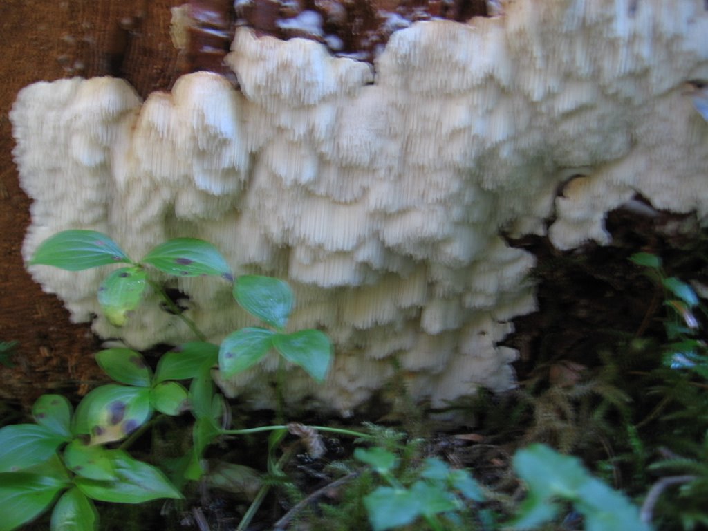
Thursday, September 21, 2006
Waiting for the Shrooms
Still waiting for the fall mushrooms to start popping. We found this one in the woods today. It was growing out of a fallen maple tree. The cap is 3.5 inches at it's widest point. Click on the pictures to inlarge them.
Friday, September 15, 2006
Rain Rain It's a Good Thing
 It is raining, not too hard but I think it's enough. Enough for what? Mushrooms of course! I hope to start finding chanterelles in a few days. It rained earlier this week but it was a really light rain. Hopefully that last rain combined with today's rain are enough to start the mushroom production.
We had a nice walk around town in the rain today. It was not raining when we started our walk and we did not let the rain cut our walk too short. I was quite surprised when one of my neighbors said we were crazy for being out in the rain.
My reply to her surprising comment was " We're natives."
Is it really such a shocking thing to go for a walk in the rain in an area that gets 60 inches of rain a year? Here you either walk in the rain or you stay indoors for 9 months.
Anyway our walk was quite pleasant. We stopped by the new (and only) Starbucks in town and I treated myself to a drip coffee and a doughnut while the kids drank pop and ate doughnuts. We are not big on junk-food and even drip coffee at Starbucks is expensive so this is not a normal thing for us to do. For some reason our stop at Starbucks really cheered me up, well that and the rain and the beautiful double rainbow we could see from our table.
After I left Starbucks I was feeling so cheerful that I wanted to sing, but alas I don't know any songs about mushrooms and it's not normal in this culture to break out into song on the public streets. Is it normal anywhere? I don't know.
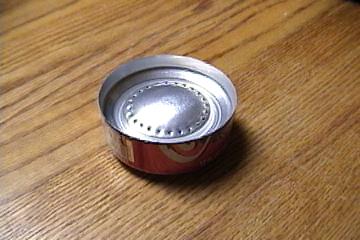
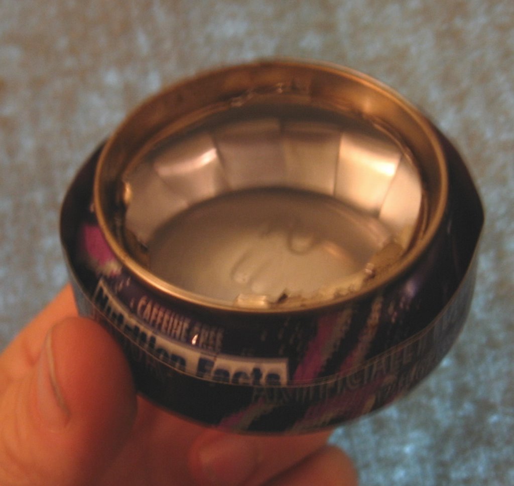 While we were eating at Starbucks I constructed a backpacking stove from one of the kids pop cans. I tested the stove when we got home and it seems to be the best one I have ever made. It brought two cups of water to a boil in 7-8 minutes and kept burning for about 12 minutes using about two tablespoons of HEET.
Mount Rose is still on fire and the burned area has grown to 1,055 acres. A few good hard fall rains should put it out.
Sunday, September 10, 2006
School and Flu Season Starts Again
Yep you guessed it, school has started and we are all sick. Every year it's the same, the first week of September we get sick and we stay sick until winter break. One particularly bad year we stayed sick until spring break. chool has been back in session for three days and I am running a fever and feel like shit. No hiking for me this week.
 Mount Rose is still on fire and it has rained but not enough to put out fires or to kick start the fall mushrooms.
There are no plans to open the road below Mount Rose before spring. The only plan is to have an agency look at it in the Spring. That means the Staircase area is going to be closed all winter.
This is a real bummer for me. I'm not sure where I will hike this winter when the snows come. The North Fork Skokomish trail was my favorite winter hike because it is a lowland trail and it is close to home.
The only nearby lowland trail that will be open this winter is the Lower South Fork Skokomish. There is some nice old growth on that trail but it's not the best trail for a wilderness experience. There are not as many mushrooms on the Lower South Fork Skokomish trail. Horses and mountain bikes use the trail and the horses have left behind weed seeds in their poop. The side of the trail is lined with non-native weeds. The middle of the trail is festooned with piles of horse shit.
I've only run into mountain bikers on the trail once and they were very polite folks and I don't see signs of mountain bike damage on the trail. Wish I could say the same for horse folks. Now I really understand the saying "get down off your high horse".
I'm trying to come up with alternatives to hiking the Lower South Fork Skokomish trail over and over and over this winter. I guess my snowshoes will be getting a bit more use and I'll be putting a lot more miles on my car. I'll have to get up earlier to off set the short winter days at this latitiude. But I also have the day care's schedule to think of. If my husband is working I can drop the baby off at 6:30 and have to be back by 3:30. If I have to dive 2 hours to the closest low land trail that leaves only 4 hours for hiking. If my husband is home he can pick up the baby and give me more time to get home.
Hiking is going to be more expensive this year because I have opted to pay $25.00 per day to have the baby go to preschool while I hike. This will be less worrisome for me then having my husband watch her. He's a good man but he is in his words "not very domestic". You ladies know exactly what that means and I don't let him get away with it when I am at home but what can I do when I am out hiking?
If he would quit smoking we could all go hiking together but that's a whole nother subject.
If this post seems disjointed it probably is. I'm running a fairly high fever and need to go back to bed.
Trails that will be closed all winter include:
Olympic National Park Closures
The entrance to the National Park at Staircase is closed. The following trails in the National Park are closed: North Fork of Skokomish River, Wagon Wheel and Staircase Rapids Trails.
Olympic National Forest Closures
The following trails are closed: Mt. Rose, Dry Creek and Copper Creek.
Not mentioned above are the Shady Lane Nature Trial and the Six Stream Trail.
Wednesday, August 30, 2006
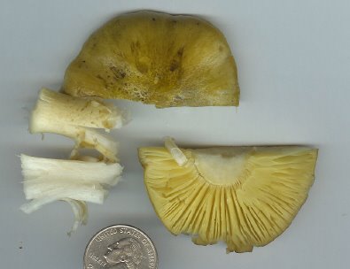
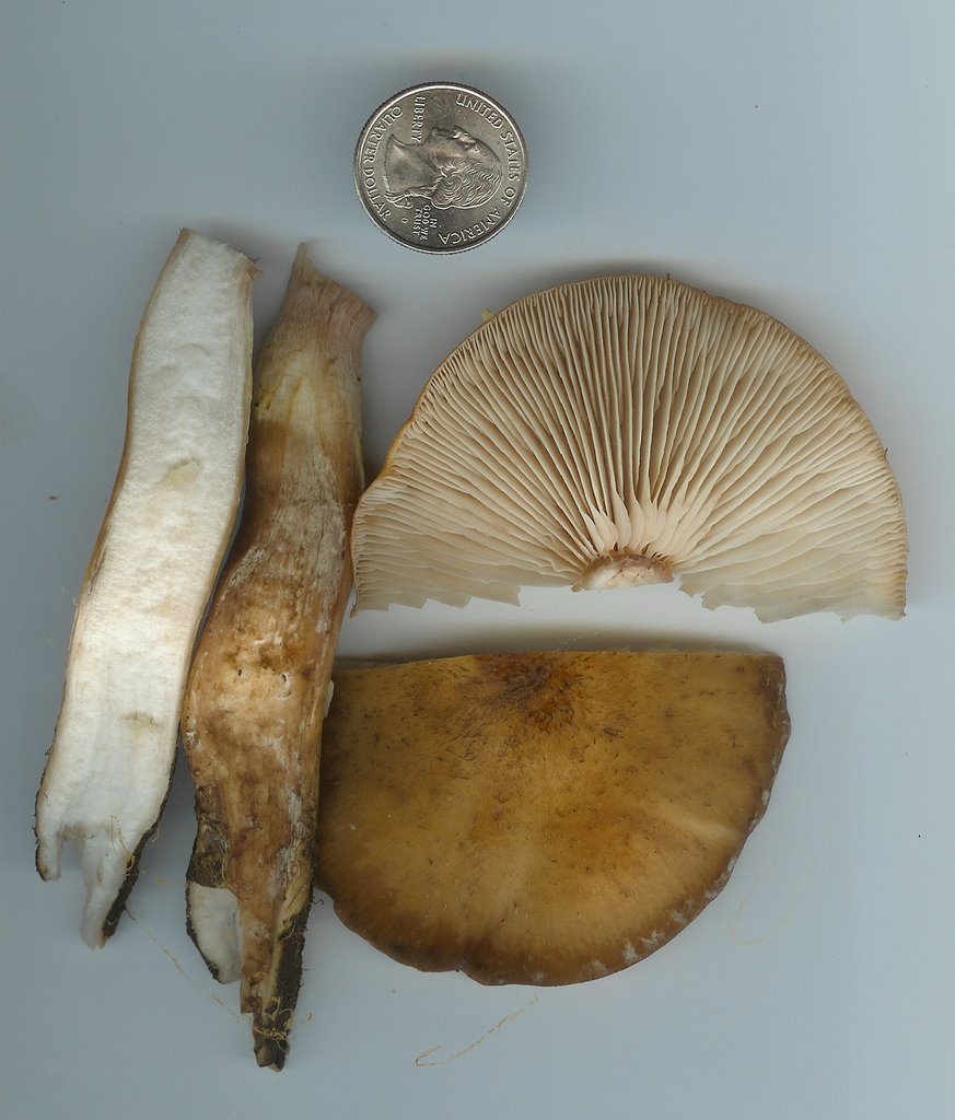
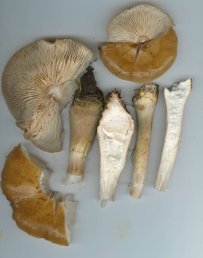
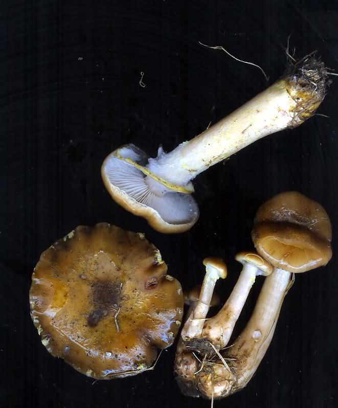
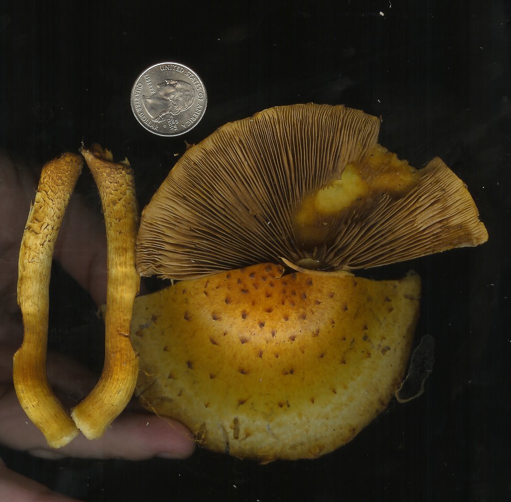
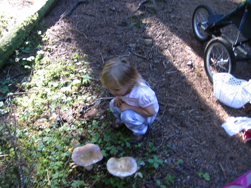
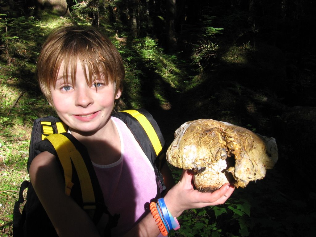
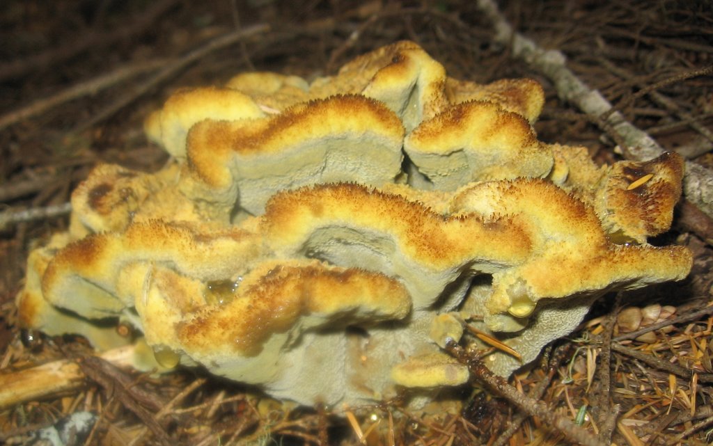
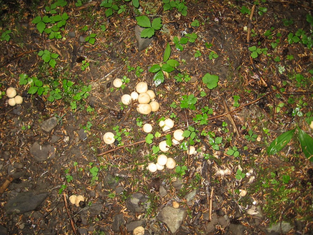
Fall Mushrooms on the Upper Big Quilcene!
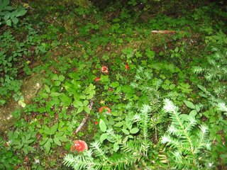
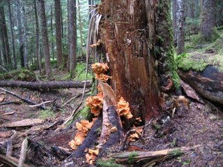
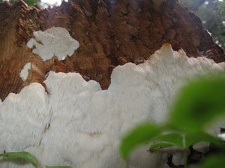
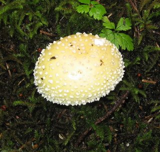
How exciting, it's mushroom season again. We have not had our fall rains yet so I was not expecting to see these mushrooms today. These were all in a river drainage area that is moist from snow run off.
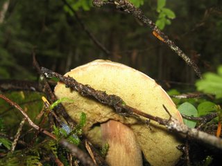
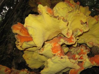
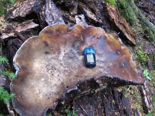
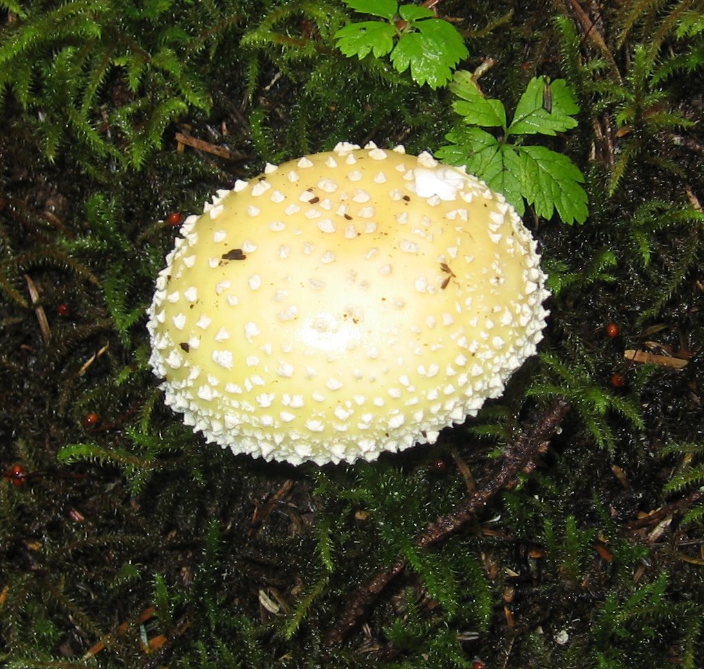
Today I hiked up to Marmot Pass on the Upper Big Quilcene trail. I went a bit beyond Marmot Pass and climbed up to a 6,700 foot peak. It's not the highest peak on Mount Buckhorn but there was a geocache there. The area was totally socked in by clouds with no view at all. What a shame after such a hike to not get to enjoy the view. I could see no reason to go to the highest peek other than to say I did it since there was no view today. I have been on the highest peak in the past and the view then was breathtaking.
I felt really dizzy weak on the way up and it took me 5 hours to go up but it only 2.5 hours to go down. I felt good at the end of the hike in spite of my troubles going up. My total time on the trail today was 8 hours. My elevation gain was 4,202 feet and mileage according to my GPS was 14.
Click on the pictures to make them bigger. My guesses as to what these are from Left to Right:
Scaly Chanterelle, A Russula?, a White colored Bolete with white spores, more russula, Chicken of the Woods, Young Lions , A strange looking polypore, Panther Amanita or maybe Amanita muscaria var. formosa, Puffballs, Underside of same White colored Bolete, close up of Chicken of the Woods undersides, A giant dead conk


Today I hiked up to Marmot Pass on the Upper Big Quilcene trail. I went a bit beyond Marmot Pass and climbed up to a 6,700 foot peak. It's not the highest peak on Mount Buckhorn but there was a geocache there. The area was totally socked in by clouds with no view at all. What a shame after such a hike to not get to enjoy the view. I could see no reason to go to the highest peek other than to say I did it since there was no view today. I have been on the highest peak in the past and the view then was breathtaking.
I felt really dizzy weak on the way up and it took me 5 hours to go up but it only 2.5 hours to go down. I felt good at the end of the hike in spite of my troubles going up. My total time on the trail today was 8 hours. My elevation gain was 4,202 feet and mileage according to my GPS was 14.
Click on the pictures to make them bigger. My guesses as to what these are from Left to Right:
Scaly Chanterelle, A Russula?, a White colored Bolete with white spores, more russula, Chicken of the Woods, Young Lions , A strange looking polypore, Panther Amanita or maybe Amanita
muscaria var. formosa, Puffballs, Underside of same White colored Bolete, close up of Chicken of the Woods undersides, A giant dead conk


Tuesday, August 29, 2006
Mount Rose Trail on Fire too
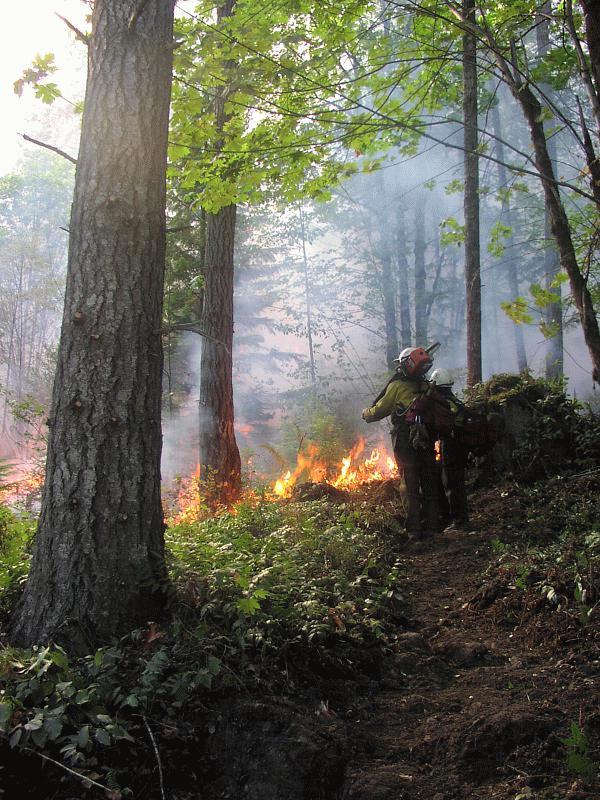 I get to go hiking tomorrow, it's been a while. My boil is finally gone and I can sit comfortably again. The fire on Mount Rose has crossed over the Mount Rose trail. I don't know if that is the trail in the picture to the left with the firemen or if that is a clearing that the firemen have made.
They are fighting fire with fire on Mount Rose the the picture to the left is a fire that was set by Firefighters.
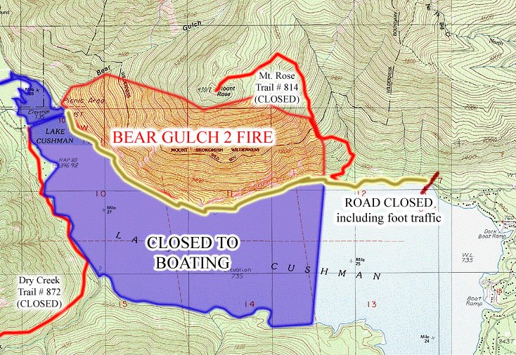
Click on any of these images to enlarge them. The topo map below clearly shows that the fire has gone over the trail.
Saturday, August 26, 2006
I've got a Boil and Mount Rose is on Fire
It started right after our backpacking trip to the ocean and required a trip to the er to get it lanced. It was painful and horrible and a terrible way to end my summer. But I hope to be able to go hiking again soon. I had to get it packed three times but the final packing came out today. Now I can sit down without a huge amount of pain. I've never had a boil before and I sure don't ever want to have another one! My pharmacist has armed me with Keflex and Vicodin but I've not had to take a Vicodin for two days now. Hopefully the grogginess caused by the Vicodin will go away now.
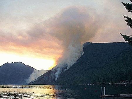
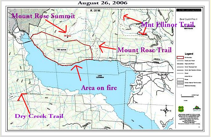
 In the meantime Mount Rose is still on fire and it is now 750 acres. But it looks like they finally have enough people and machinery in place to really start fighting the fire. You can see some of the smoke from this Hood Canal Webcam.
The Mount Rose trail has not been encroached by the fire but they are starting to mention fighting the fire from the East side of what they call "The Mount Rose Pathway". The fire started on the West side of the Mount Rose Trail if they are fighting it from the East Side of the trail that is not good news.
If you click on any of these pictures you will get to see a much larger image.
I don't know where I will hike next week. Clearly I will not be hiking any of the Staircase Area trails as they are all closed. Mount Elinor is open but in the smoke.
Perhaps I will do the Upper South Fork of the Skokomish Trail. There is just over one month left before car access to the trail head gets cut off until next spring.
The maple trees across from my front yard have started to change colors. I hate how maple trees are the first to announce that the end to summer is nearing. But at least this year I can look forward to the fall mushrooms and I know exactly where to look for them this season.
 While convalescing from my boil I have kept entertained by reading the journals from folks who are currently through hiking the Pacific Crest Trail (PCT) and by tinkering around with home made alcohol burning stoves. It is my dream to through hike the PCT once my kids are a bit older. Perhaps I can try it as soon as the year 2010.
Subscribe to:
Posts (Atom)