We camped at Heart-o-The Hills campground near the Hurricane Ridge entrance station just outside of Port Angeles Washington. My husband and the kids slept in the next morning. I got up and 6:30 had a cup of tea and a bagel with peanut butter on it and then set out for the trail. From our campsite to the trail head is about half a mile.
I reached the trailhead at 7:15 am and started my hike up. The plan was for the rest of my family to sleep in and then drive up the road to the visitor center and give me a lift back down to the campground.
Three quarters of a mile into the trail I heard a crashing sound in the woods ahead of me and then to my left. I thought it was a deer running away, but I thought wrong. IT WAS A BEAR! The first bear I have ever seen while out hiking and the first bear I have seen in the Olympics. The bear only let me have two brief glimpses of it's big fuzzy black butt as it ran away a the speed of light. I SAW A BEAR!
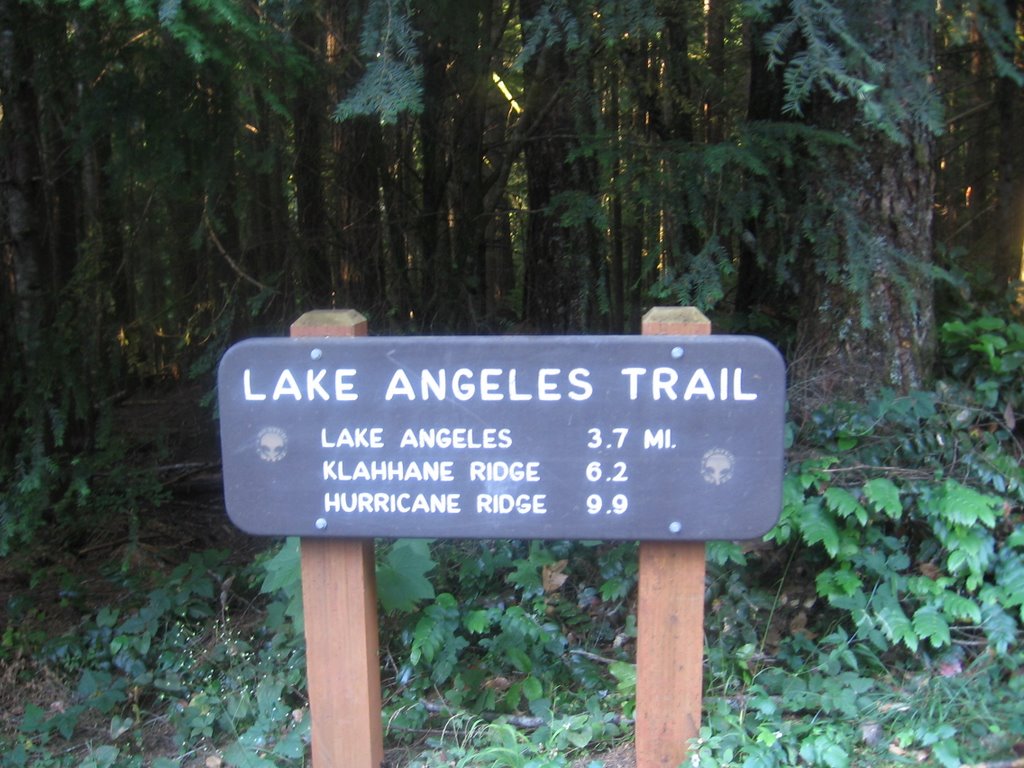
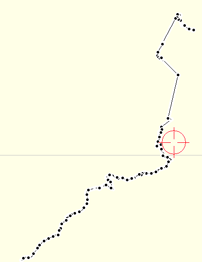
I thought this hike was 10 miles uphill all the way with about 3000 foot elevation gain and it topped out at 5240 feet while starting at 1800 feet. But I was wrong.. The trail starts at 1800 feet but it tops out at 6000 feet at about the 5 mile mark and then it meanders up and down and around the ridge line for the next five miles.
I was not looking forward to hiking uphill for ten miles and was wondering how I was going to get to the lodge before dark as I was only hiking 1 mile per hour! But then I saw that I was already at over 4000 feet even though I was only 3 miles into my hike. I knew something was not right. I dreaded that I was going to have to lose all that elevation gain only to regain it. But I was actually going to be walking along a ridge for the last 5 miles.
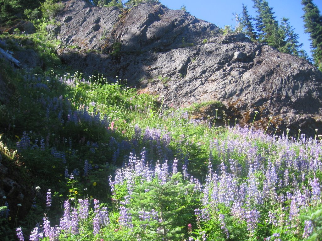
The ridge walk was lovely but the prettiest part of the trail was before I topped the ridge. Beautiful meadows of wild flowers, patches of snow greeted me there. I did not hike down to Lake Angeles even though was the last place to get water. Instead I got my water from a snow bank on the ridge. I was pretty hot and tired by the time I reached the first snow so I sprawled out in the snow and ate some to cool off.
I think my total elevation gain for this hike was
 4,450 and my mileage was 10.5 by the time I add in the walk to the trail head from my campsite.
That's a 28 (top of the scale) on the Hike Difficulty Calculator
I had the trail all to myself until I reached Klahane Ridge. Quite a few people hiked up to the ridge on the shorter Switchback trail instead of the Lake Angeles trail. As I got closer and closer to the visitor center the "hikers" got fatter and fatter and also became a bit less friendly.
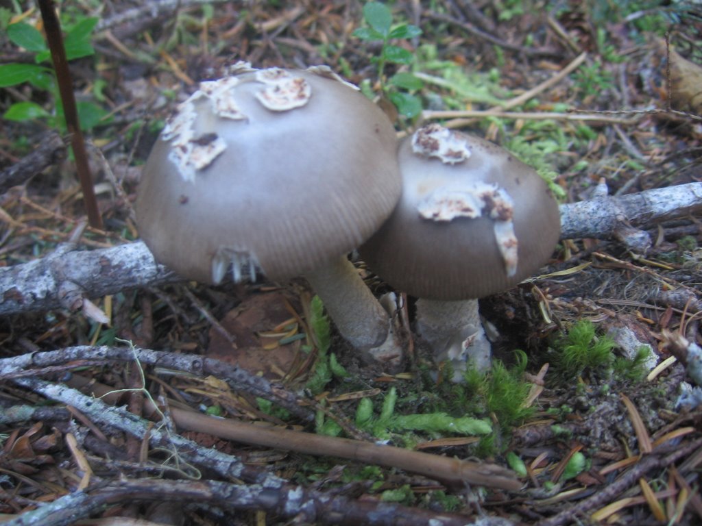
I saw a lot of dried up coral mushrooms, a pretty orange slime mold and these mushrooms on the left.
At the end of this hike I was really feeling good, like I had acomplished something and saw some nice sights. I want to do this one again. Did I mention that I saw a bear?

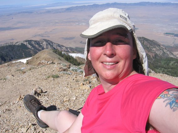
 The view from the top was awesome but I was feeling the altitude. I had vertigo and my stomach was upset. I live at sea