
I had a great hike-n-bike today!
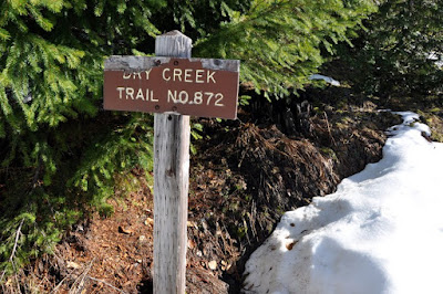
I’ve been wanting to see the top of the Dry Creek Trail for a while now. I had been up the trail a few times but unbeknownst to me I had never made it to the top. I always turned around at a little campsite on the ridge because I thought that was the top.
The shortest route to the top is from the Southern Trailhead so I tried to get there from southern trailhead a few months go but the snow stopped me. This time there was a lot less snow and I made it to the pass.
I set my alarm for 7:00 and when it went off I turned it off because I did not feel like getting up and going hiking in the dark. Then at about 7:30 my oldest daughter woke me up to inform me that she had missed her bus and needed a ride to school. This happens all too often. I was almost packed to go and I thought about going directly after dropping her off at school. But I decided I needed time to wake up so I could pack a bit better so I went back home and had some breakfast and then loaded up my bike and dog into the Jeep and headed for the trail at about 8:30.
I meant to get my waterproof hiking shoes out of my car and put them into my Jeep for this hike, because I knew that I might run into snow. But the added stress of dealing with my daughter caused me to forget my shoes. So I had to hike in an old pair of running shoes that were not at all waterproof and had very little tread, but at least I had my gaiters with me this time.
When I reached the Lebar Horse Camp trail head I saw 4 brush picker vans parked up there and I wondered how far in the brush pickers hiked to reach their salal. I left the Le Bar Horse Camp trail head at about 9:15 and I rode my bike until I reached the steep turn off to the right. Then I mostly pushed my bike all the way to the Dry Creek Trail Head.
 Taking a break on the ride up
At this point the Dry Creek trail is just an ugly old logging road that was abandoned and “converted” into a trail. After a mile or so the actual trail is reached.

This trail used to start at Staircase (the shady lane nature trail was part of this trail) and go all the way to Le Bar Horse camp where my Jeep was parked, but the high country in this area was savagely logged by Simpson under the 100 year sustained steal contract. So, not much of the trail or the forest is left. About a mile before the actual trail I saw some huge mountain lion tracks. Those tracks made me a bit nervous; I had never seen such large cougar tracks before. A cougar that size could have taken my down with one swipe of its paw.


 I was glad when I finally got off the ugly abandoned logging road and reached the trail.
 The woods there were a very nice mix of hemlock and cedar. At the start of what is left of this trail I found what looked like an old shelter site. What a shame so little is left of this trail and this forest! There was a fair amount of snow (complete with cougar tracks) on the trail and the snow was hard and slippery. I was not sure if I was going to be able to make it to the pass in my shoes with no tread and with no trekking poles. But I found a nice walking stick in the woods and I managed to pick my way up to the pass.


At the pass I was surprised by the view. I was not expecting to see Lake Cushman from there. There was snow all around me and it was beautiful. But still, there were ugly signs of logging all around to remind me of how this land has been raped. Only the narrow ridge that the trail was on had been spared from logging. This area has been logged up to at least 3,800 feet.


 I can see how it would be easy enough to find my way up to the top of Dry Mountain from this pass and I intend to try to do that this summer when the gates are open and I can start my hike at the current trail head.
 Dry Mountain
After I passed Lebar creek and the current trail head I bombed down the logging road on my bike and it was great fun coasting over all the water bars. I think that is the most fun I have ever had on my bike without breaking a bone.
 Lebar Creek
From one vantage point on the 2353 I could see clouds down below me. I was only at 2,500 feet but I was above the clouds. I decided to linger at that vantage point for a little while so I could enjoy the sunshine before I had to drop back down into the clouds and below.

At 2,500 feet we were above the clouds


Just barely above the clouds now
The clouds are on the road ahead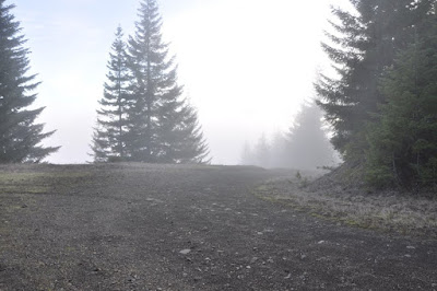
Now we are in the clouds
The air quality in Shelton has been terrible this winter and I was enjoying the relatively clean air up above the smog and cloud layer. If we get a biomass in Shelton I’m going to be very tempted to move to Oregon where the air pollution laws are stricter.
After I reached that vantage point I had a long and fast downhill ride to my Jeep. I had to stop a few times so my dog could catch up to me and rest. I hope that I did not put too much stress on her body. She always tries to run directly in front of my bike and I know that one day I am going to run over here and we will both get hurt. To avoid running over her I ride just a little bit faster than she can run.
About 1 mile before I got back to my jeep I saw three South American Indians walking down the road I was bombing down. They carried HUGE loads of salal on their backs. The bundles of salal were almost as big as they were. I sure was glad to be coasting down the hill on my fancy bike instead of having to haul out loads of salal on my back.
I really enjoyed my hike and the new things I got to see.
19 miles
2,700 feet elevation gain
no miles on my new shoes
Some ups and downs
View from the pass
Either Mount Tebo or Copper Mountain
Some sweet light on my way back down the trail
Ugly old abandoned logging road
Nice crusty snow
Perhaps lightning peak
Prospect ridge from the 2353
One puffed pup
Uploading images to blogger is a PITA. For one you can only upload 5 at a time and the folder view is always in alphabetical order. I want it in order of the time I modified it. When I upload to my flickr account my folder view is always in the order the picture were modified and I can upload the whole folder at one time.
1 comment:
Hiking alone is pretty safe. You just always have to pack enough stuff so you can survive a night in the woods if you need to. I have a spot messenger that can theoretically alert my husband if I run into trouble.
I'm not in such good shape now after having to take so much time off for my ankle.
Post a Comment