After sleeping in I woke up to a beautiful sunny day. A quick look at the weather forecast for the upcoming week told me that today was the day to hike. I left my house at 10 am and I was in a hurry to get to the summit before cloud could move in to block the view.
On the 800 line I got stuck behind a Ham radio operator on his way to South Mountain. I could tell he was a Ham by his license place. I knew he was going to South Mountain because there is a Ham tower up there. I don't know if he ever noticed me stuck behind him. He turned off at the entrance to North Mountain and then he drove out via South Mountain. He damn near ran me over on his way down. I hope he and his female companion enjoyed the view anyway.
I hope that someday I can make friends with one of those Hams (is there a capital "H" in ham?) and convince them to open the gate and let me drive my husband up there. Hams have the key to the gate and my husband will never be well enough to hike up South Mountain.
When I got to the top I was once again surprised by the 360 degree view. I had forgotten all the things that can be seen from the South summit. Things I could se included: The interior of the South Olympics, Several Cascade volcanoes, Hood Canal, Skokomish Valley and Grays Harbor. It was very windy on the summit and I stayed warm by wearing a down jacket with full rain gear over it and by wearing my mountaineering gloves. The wind made strange and loud noises as it blew against the radio gear. My dog seemed to be warm enough in just her fur coat.
I had expected to run into ice up there because it has been so cold and dry down here at sea level. I brought my crampons, gaitors and boots because I was expecting poor traction but there was no snow on the entire mountain. It turns out that it is colder at sea level than it is at 3,000 feet!
"Air stagnation advisory remains in effect until 10 AM Saturday. Forecasters say strong high pressure will persist for the next couple of days, trapping cold air near the surface under warm air."
When I was done at the top I decided to walk the ridge to the North Summit. I was hoping to get a peek at Haven Lake from the North Summit but I was disappointed. When I got back to the saddle I saw that the sweet light was in and sunset was near, so I decided to go back up the summit. I was rewarded with a view of the sun setting over Grays Harbor. I though about staying up there until it was completely dark but I did not want to hike out 4 miles in the dark so I left at dusk.
Still I had to walk about 3 miles in the dark with my headlamp on. The moon was half full so it provided a bit of light and some scary tree shadows. I was a little freaked out hiking in the dark; I wish I could get over that. I think I should go back up there for the sunrise one day then I can hike up in the dark and down in the light.
When I got back to my car my dog flopped down on the ground. Normally she explores the area around the car when we are done, but not this time. She was very tired from the hike. It took some coaxing to get her to get up and get in the car.
I was pretty tired too, it has been a while since I have gained so much elevation on one hike. South Mountain is not my favorite hike, but it is a good hike for keeping in shape during the winter and I always get solitude up there.
12 miles
3,600 total gain
57 miles on my new boots and they seem to be leaking already. They also give me blisters every time I wear them.
So far this year this year have hiked 27 times for a total of 260 miles and 64,341 feet elevation gain.

Sun Shadow

The South Summit

Mount Cruiser

Skokomish Valley

Seattle is behind the tower to the left

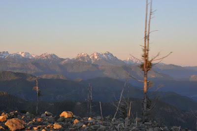
Alpenglow on the mountain

St. Helens Aplenglow

Alpenglow on the Olympics

Old Growth Stump
I bet this area gets logged again soon

North Summit

North Summit

What has been using this trail and where does it go?

Middle "summit"

Why were these logs wasted and when?

Sunset over Grays Harbor

See the stagnant air?

View on the way down

Moon Shadow

Some totals

Elevation profile

Playing around with Pano software

What has been using this trail and where does it go?

I got some help labeling these peaks from the folks at NWhikers.net


Near the start of the hike.


No comments:
Post a Comment