Showing posts with label Haven Lake. Show all posts

Friday, December 11, 2020

Cold and geocaches at Haven Lake on Bike


I woke up and remembered it was hiking morning and I just wanted to go back to sleep.  What happened?  I used to be so excited to get up on hiking morning, but I’ve not felt that for a few years now except for when I have a new hike planned.

I think I’m just bored to death of all the local trails.  I’ve done them all dozens of times and they are getting more crowded.

This morning I wanted to go back to Haven Lake to place a geocache, find some geocaches and to look at the old road that runs next to the lake.   

I woke up and looked out the window and saw rain and it made me happy, it meant that I could cancel my hike with no guilt.  I used to hike in the rain all the time though.  

I was not able to fall back to sleep and the sun came out!  I checked the forecast and it said that more rain was likely but only 1/10th of an inch.  The hike was back on.  

I felt a bit more inspired to hike remembering that I had geocaching missions in mind and that the gate to the evacuation route and or the 800 line is probably due to close on December 31. 

Once those gates are shut I will probably never get to go back to South Mountain or Haven Lake again since I am moving to in the spring.  

So off I went on my bike and with a big heavy geocache in my backpack. 


Soon it started raining, but no worries 1/10th of an inch is nothing! 


Of course the weather guessers were wrong  the rain kept falling harder and harder and being on a bike I was really getting soaked.  Soon the rain drops began to get fat and white, but never quite turned into snow.

I gave up on finding any geocaches, it was too cold and I was not patient enough spend much time looking for them.

I  continued on to Haven Lake to hide my cache and it was just pouring.  It was okay though, I always have a tarp in my backpack these days.  I leave it in all the time no matter what the forecast so I will always have it when it is needed.

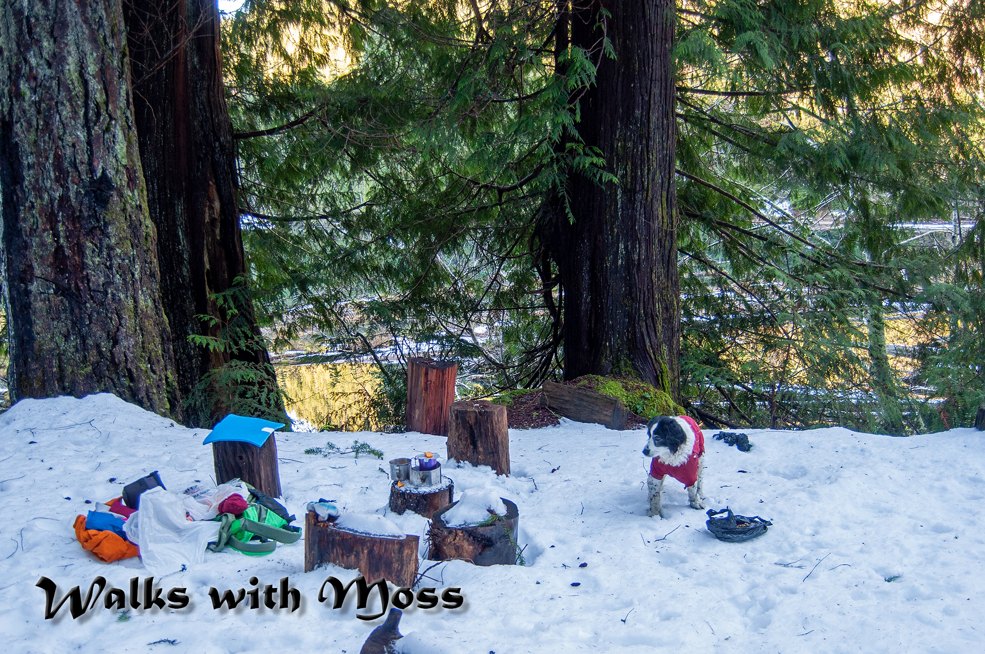
I pitched my tarp at the lake shore, started up my stove and hid my geocache.  Then I had a nice hot lunch and hot coffee at the lake under my cuben fiber tarp.

The trip back out was short but cold.  Thanks to my bike I finished my hike well before dark. 

I was home for about 4 hours before I felt warm again.

6.5 miles 600 feet elevation gain


Friday, December 4, 2020

Haven Lake with Patches

Patches at Haven Lake in 2016 Patches died this same year


I've not been to Haven Lake in a long time since the 800 line is mostly red dotted now.  Thanks to the popularity of the Vance Creek Bridge (I think) the 800 line and the evacuation route are red dotted for most of the year.

Right now only the gate that leads directly to the path that goes to the far side of the Vance Creek Bridge is shut.  I've heard the path there is heavily marked with no trespassing signs. 

This hike is entirely a road walk and it offers a bit of solitude. I'm only blogging about it because I am probably about to move and won't need to protect my solitude in the Olympics after that.

There is a really good view of the Vance Creek Bridge from the road leading to the lake.


At the lake I brush crashed on a way trail on the far shore for a bit.  The woods there are nice and I found some late chanterelles.  I had my lunch at the old car pull out but fist I hid some of the trash from my view.

The car pullout is the only place to sit with a good clear view of the lake but the area is trashed and does not feel very nice.

I ran out of light on the way back, short winter days are hard on a mushroom hunting night owl.  I get caught out in the dark quite often. 

I could not decide where to spread Patches ashes because we went together to so many wonderful places.  Instead I have decided to leave little bits of her in special places over the next few months. 

7 miles 500 feet elevation gain


Stay away from this side of the Vance Creek Bridge it is well posted and is dangerous.  Visitation is only allowed on the other side of the bridge.  Still struggling with bloggers new photo format and don't have the caption option figured out yet.


Not the Vance Creek Bridge.  


Looking up to the about the site of an old airplane crash 
a landslide took the debris away.  

Falls Creek

Snow capped Mount Ellinor.  Very little snow for December!


I think this is a pile of dog ashes that someone left very recently
It seems that Patches will have company here.

A bit of Patches waiting to go for a swim with the next rain


2011 Patches Haven Lake

2016 Patches Haven Lake


Monday, January 11, 2016

Haven Lake


Haven Lake

A gate is closed preventing access to South Mountain. The road is also red dotted.  So we went to Haven Lake instead.

 did not have my gps as I was planning on a straight forward hike up South.  I found the lake just fine without my gps and on a slightly different route than usual.

I could see a lot of people down on the Vance Creek Bridge.  I'm glad that I got to see the bridge before it was popularized on the Internet by folks who are out to make a buck.

There was shallow crusty snow for most of the route.

We saw bobcat tracks and Patches ate a lot of bob cat poop.  She refused to eat the dry dog food I packed for her. She much preferred to eat wildcat poop.

6 miles with 450 feet elevation gain

It would have been under six but I did some backtracking after I found my hiking partner who was hiking in as I was hiking out.

Bob cat tracks
The days are getting longer and we made it out before dark

Fog covers half of the Skokomish Valley


The Vance Creek Bridge was crowded

Phil brought his ultralight stove

I found a shelf fungus to set my coffee cup on


Monday, March 21, 2011

Haven Lake in Simpson / Green Diamond Wasteland

Skokomish Valley


Haven Lake is on Simpson / Green Diamond land.  I’ve been wondering how to get to Haven Lake for a while now, and I’ve tried to drive to it twice with no luck. Today I finally decided to really figure out where this lake was. I was feeling a bit out of sorts this morning, and I was not in much of a mood to hike today, but I had to go today if I was going to go at all this week, because my kids are on half days for the rest of the week.
I started my hike at the end of a dead end road off of the Simpson 800 line, outside of Matlock. I had been down this road before and I remembered that something on this road had abruptly turned me around. I forgot exactly what it was though.

Old railroad tracks

abandoned train bridge

This road is an old rail line, some rails are still there, with trees growing up between them and a well preserved rail bridge is still in place on this road.  

As I approached what I knew was going to be the end of the road, I wondered what I would find. What was it that had forced me to turn around in that spot before? There was dirt mound blocking my view of what ever was at the end of the road.  What was on the other side of this, I wondered to myself? Was it a sheer drop off? Was it a wall of forest?


What is at the end of this road?
 
Nope, it was neither of those things . So what did I find there? 

I found helicopter landing pad. Yep, a helicopter landing pad. What a thing to find out in the middle of nowhere!  The pad has not yet been used, I assume that when it is used it will be used to fly in a new bridge and then when the new bridge is installed the entire area will be clear-cut.   Too bad, its a pretty forest here.

The helicopter pad was at an intersection with a big logging road, upon seeing that road I remembered, it was logging trucks rumbling up and down that road that turned me back at this spot before. There were no logging trucks out today, and the hills were silent other than the sounds of rain and gunfire, so I kept going down the road where I had been turned back before.

After a bit I realized I was not on the road that the GPS wanted me to be on, I was actually 700 feet (in elevation) below where the GPS thought I should be. I did not want to bushwhack up 700 feet of thick second growth forest, so I was not sure if I was going to make it to the lake on this route. But I kept going, because the road I was on was going the right direction, even if it was too low. In about ½ mile I found an intersection that headed straight up in the direction I needed to go to get to the lake.

A snow plow has been here

It was 3 miles to the lake and I was feeling a bit out of sorts,  it was foggy and raining, I was surrounded by stumps , there were no views, and I kept thinking about the time my Jeep got hit by a logging truck not far from where I was parked today.

 I knew I was on a main road and maybe another logging truck would come down the road, so I did not wear my MP3 player, because I needed to hear if any trucks were coming. So why didn’t I just drive down this gargantuan logging road?  Because it’s locked off, like most of the other roads in the area. I don’t think that Simpson wants people out there playing at Haven Lake or on the South end of the Vance creek bridge. But it’s ok to hike out there.

After a few miles of slogging down the logging road in the fog, I reached the lake. Yay! I found the lake. The lake is pretty and it even has a couple of old growth trees on its shores. But, Bubba and friends have been to the lake so there was a lakeside campsite filled with broken glass, toilet paper and empty beer cans. Oh well, it was still a pretty lake. I sat near the lake and nibbled on my lunch while brewing a cup of tea. While I was eating the sun came out and I cheered up a little bit.

Tree Grows out of Log in Middle of Lake.  Carbon goes into tree, not air!
Dual culverts for the outlet stream
Campsite with Bubba signs

After about 20 minutes, I headed back home without doing much exploring of the lake. The lakeshore was too steep to walk around.. On the way back the clouds started to part and I was startled by the views that I had missed on the way up. I found a really good view of the Vance Creek Bridge, the surrounding hills and the Skokomish Valley. Seeing this view cheered me up and made me want to come back and explore this area again. I sat at the view point for about 15 minutes, soaking up the views and taking pictures. As soon as I got up my right ankle flopped over fairly hard, and it still hurts.

Looking down on the Vance Creek Bridge
Vance Creek Bridge, Clear-cut hill and Skokomish Valley
I got back to my car at about 2:30 and I made it home before the kids. All in all not too bad of a day, I hope my ankle feels better tomorrow.

6.5 miles with 700 feet elevation gain


Old Growth Stump


Simpson Wasteland