Wednesday, January 29, 2020

Dayton Falls


Still sticking close to home with the bad weather and some lack of motivation to go for long drives.  I'm driving a lot on the job now and so I like to save some wear and tear on my car. Also with the days being so short it is nice to be able to hike close to home so I don't have to get up too early in the morning.

I wanted to try to get down to Goldsbourgh Creek and explore and area past where I turned around the last time.  I knew it was not the best idea to try to get through a wetland in the winter but it was worth a shot.

It got too swampy well before I reached the Creek so I turned back and then attempted to make a loop.  I did not know if I could connect the loop but I was so close I had to give it a try.  I was on an old road and it looked sort of okay. 

I was almost able to complete the loop on the old road when the road suddenly turned to pure swamp.  It seemd a better bed to cut through the woods to make my loop than to try to continue on the road.

The woods, really an herbicide drenched tree farm, were easy to cut through cross country due to the lack of undergrowth.  I decided to roughly follow a little stream that had turned into a raging torrent with all the recent rain.  Then I saw it, a waterfall!  The things you can find when you go just a little bit off trail or road always surprise me.

It was hard to get a good angle to view the falls and the banks on either side of the creek looked very unstable.  The creek had cut a ten foot deep (about 3 meters) gouge into the soil.  I've seen this in tree farms before. 

I was so ready for lunch at this point but I did not feel like I could relax enough to enjoy my lunch until I knew for sure I was going to be able to complete my loop without back tracking.  It was getting close to sunset and if I had to back track I would risk getting caught in the dark.  So I did not have my lunch at the waterfall and instead I hiked out to a road to complete my loop.

Once I was at the road I could have taken my lunch break but I realized I was so close to my car with a can of root beer in it,  I decided to just hike to my car and have a root beer. I could then have lunch in the comfort of my home.

5.5 miles 400 feet elevation gain


Monday, January 20, 2020

Jackpot Lake


First hike with my new used D7000 camera.  I got it as part a  bundle with a lens I really wanted for the price of what I expected to pay for just the lens,  so it was basically a free camera.  It replaces my stolen D7100.  

There is too much dirt on the image sensor of my Ricoh GR II yet again and I don't feel like tearing it apart for a third time. Each time I tear it apart I risk breaking it and losing more screws. 

I feared that there would still be a lot of lay laying snow around and I did not particularly even want to hike, so I went to Jackpot Lake.  Once I got out there I felt good and was glad I made the effort.

I started this hike with Sage at about 10am. I parked at the end of Lake Nahwatzel Road.  As soon as I got started I realized that I still have not updated my gps with maps from the USA. So again I would be hiking with no map.

It did not take long at all until I realized I had made a very wrong turn.  I thought about just walking back to the car since I did not want to do the extra miles caused by having to backtrack.

But in the end I decided to keep going to the lake. I was having fun and it felt very peaceful out there and there was not much in the way of fun waiting for me at home.

I could have pitched my tarp at the lake but instead I just used my umbrella.  At the lake the weather was dry until I was all packed up, so I just pulled out my umbrella and finished my cup of tea under the shelter of my giant umbrella.

I really like having a coffee, then my noodles and then a hot cup of water or tea.   That second hot cuppa makes me feel nice and warm.

The hike out was straight forward with no wrong turns and just a little bit of route finding on my cell phone.  I had okay cell coverage the entire time so I was able to keep up with friends and family while I was out.

5 miles with maybe 100 feet elevation gain.  My GPS needed to have it's altimeter calibrated. 


Dayton Dog Walks


I'm back home and the days are short and it is cold.  Most of the trail heads are snowed in.  I'm opting to take shorter "hikes" that are close to home and don't keep me and Sage out in the cold all day.    The Dayton forest is just outside of Shelton and has a few places to walk.  Dayton peak  is a nice hike and I will be back when the parking spot at the gate is snow free.

Since I got back I am bored and lonely and anxious, another reason to go on lots of shorter hikes.  I can do the shorter hikes more often so I have less days when I am bored. The idea of a shorter hike produces less anxiety when I am forcing myself to go out too.

Since these are short logging road hikes and the weather is foul, I've started taking an umbrella with me.


Tuesday, January 14, 2020

2019 Graph


I got a few more miles in this year.


Tongariro Crossing to Soda Springs


It was too windy on all the days we wanted to go.  So we settled for a waterfall hike the day of and a hike to Soda Springs the day after.


Trail head hut


Manuka flower


5.5 miles with 740 feet elevation gain


Sunday, January 5, 2020

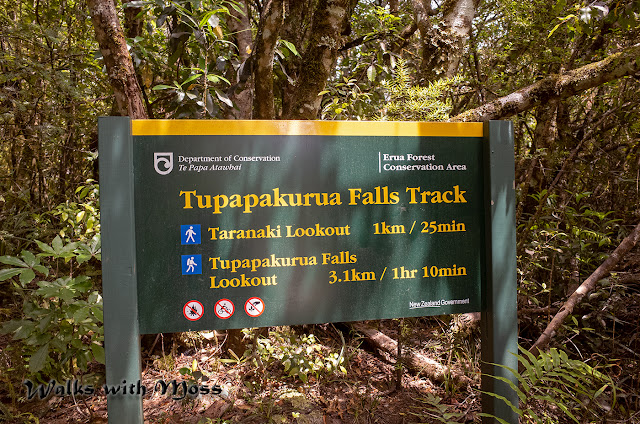
Tupapakurua Falls

There was too much wind on the 

Tongariro alpine crossing so we did this waterfall hike instead.

From the bottom of the road it was 7 miles with 300 feet elevation gain.


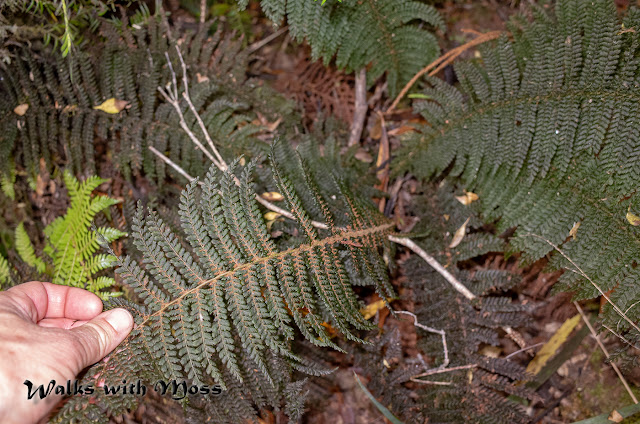
Giant Polytrichum moss 

Dawson superba  The largest in the world! 


Dawson superba  The largest moss in the world! 


I really wish that DOC would list trails in terms of Kilometers and elevation gain  instead of hours. I find measuring trails in hours to be useless. Someone can hike it in x amount of time? Not very  helpful.  7 miles with 300 feet elevation gain.
 11 Kilometers with 100 meters elevation gain