I really wanted to go see the lower big Quilcene trail today, but with the days getting short, I decided to stay closer to home instead. I guess I started my hike at about 9pm and finished at about 4:15. I found a bunch of chanterelles; more then I felt like picking. I also found pigs ears, which I picked some of, because my oldest daughter wanted me to. I think they are far too pretty to pick and they are always filled with maggots.
 |
| Pigs Ears |
I left a game camera out there today and I hope that I get some wildlife shots. I did not have any luck the last three times I left cameras in the woods. I’ll go back and check it in a couple of weeks.
A new bridge over the north fork of Big Creek has been built, it is just before the connector trail splits off; it looks like a nice bridge. My usual water source is about a half mile past the bridge and I was shocked to find that it was bone dry. With all the rain we have had, I assumed it would be running. I did not have any water and I wanted to have tea at the overlook, so I followed an old logging road out to the main road and was able to get water without losing too much elevation. Then I walked up the road for about ½ a mile before I took a different old logging road back in to the trail.
 |
| View from Lunch Spot |
The view was pretty good today except it was misty. The clouds were high, but a low mist blocked some of the view. I got peek-a-boo views of the volcanoes. An old growth mountain hemlock tree at my lunch spot is about to fall down. I drew that tree one time and only when I took the time to draw it, did I notice the bullets that had been shot into it. The tree is breaking right where the bullets went in. I'll miss that tree, but it will open up the view a bit with its demise.
After lunch, I wandered up to the beautiful old growth hemlock forest at the start of the lower Ellinor trail. I really love that forest, that was spared from logging due to being above the Douglas-fir line.
 |
| Wonderful Old Growth Forest Fringe on the Ridge |
 |
| This tree is about to fall |
I headed back down towards the car at about 2:30, this gave me 2 hours to hike out the last 4 miles before the sunset. It was nice to be able to complete my hike without feeling rushed and without getting sundowned. I took some advice from another hiker and packed my car keys in with my lunch the night before, that way I could not leave without my lunch.
I’m sorer than I expected to be this morning. Compared to my other recent hikes this was a pretty easy hike, but I’m feeling it today. Perhaps it was the extra weight of my game camera and lock box and chain and my big lens for my DSLR that made this hike harder.
My ankle was good until about 2 miles before the end of the hike and then I tweaked it a couple of times. It really hurts when the joint slides forward. Not much I can do about that other than resign myself to wearing clunky boots for the rest of my hiking days. I don’t know if there is a surgery to fix it. The last time I did this trail my ankle was so bad that I went in for physical therapy. The therapy helped a lot. My ankle is now as good as it has ever been since my bilateral modified Watkins-Jones surgery 20 years ago.
What used to be Potlatch State Park has been logged down to near the shore of the Hood Canal. When I first saw it, while driving on my way to my hike, I surprised myself by screaming a bunch of expletives into my empty car. My poor doggie probably thought I was mad at her, so I consoled her and told her she was a good dog, after I calmed down a bit. It’s going to be awful for me to drive past that area for awhile now. Just like it used to be horrible for me to drive though the clear cut outside of Mcleary.
8.5 miles
1,900 feet elevation gain
 |
| Mount Washington |
 |
| Pretty Purple Mushrooms |
 |
| Earth Tongues |
 |
| Coral Mushrooms |
 |
| Old logging road converted to trail lined with alder trees |
 |
| Close relative to the store "button mushroom" but mildly poison (based on smell and yellow staining stem) |
 |
| Morning Sun Backlights the Moss near the Lower Bridge |
 |
| Chanterelles |
 |
| Honey Mushrooms growing on "biomass" |
 |
| My turn around point 4 miles from Big CR. Camp (the sign is wrong) |
 |
| Puff Balls growing on woody biomass |
 |
| Elevation Profile |
 |
| One way track log going up |
 |
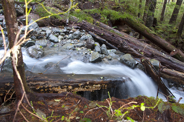
| Water fall with some sort of oyster (?) mushroom |

1 comment:
Thanks for posting. I've always wanted to do this hike. I have property in the area but haven't found any cool hikes yet. I wish there were some trails off Dow Mtn.
Post a Comment