|
| stuck behind forest service truck and S'Kallam tribal truck. |
I was supposed to take it easy today and gradually regain my ankle strength, after taking two months off hiking and going through physical therapy. So, I picked dry creek trail from the south. It would be a short hike with solitude and a view. I was also hoping to find some mushrooms as it is nice and damp up there and fall is coming. In fact, I was dreaming of matsutake as I drove to the trail head. But alas, I did not find any mushrooms on the trail; I guess it’s still too early.
I drove over all the water bars in my faithful Jeep and parked at the trail head at about 11pm. On the way in I got stuck behind a forest service truck and a James town S’Klallam tribal truck. I wonder what they were doing clear up here?
When I opened the register to sign it I was surprised to see that half a dozen other folks had signed the register this summer. I’m used to my name being the only one on the list. When the wildlife gate closes next month, I’m sure I’ll have the trail all to myself again. Three groups listed their destination as Killen or Killen meadow or the meadow. I’ve never heard of the place. But I think I might have found it.
 |
| Is this Killens meadow? It looks like a campsite. |
I started to hike and right away I hurt my ankle, so I was not too happy about that but then my ankle seemed to get better as I got warmed up. I need to remember to stretch my calves before I hike! I sprained it to the inside and near the heel but I kept on going. I wore boots on this hike to protect my bad ankle and I may just have to wear boots from now on. I feel so clumsy in boots but they do help to keep my ankle in the correct position.
I’ve never seen this end of the trail in the summer; I’ve only seen it in the winter. I was surprised to find all the alders fully leafed out and blocking the trail. By the time I got to Le bar creek my pants were soaked from the dew off all the alders. Le bar creek was so low that I was able to pebble hop it without taking my boots off. I’ve never been able to do that before.
 |
| Alder jungle |
 |
| Lebar Creek lowest I have seen it |
When I got near the old trail head I noticed something... Dry Mountain had no snow on it! I’ve been wanting to bushwhack up Dry Mountain from the dry creek trail for some time now. It looked hella sketchy to try it in the snow so I’ve been waiting for the snow to melt.
 |
| Dry Mountain with no snow |
Ok so I was supposed to take it easy, but it was kind of a now or not until next fall thing, so I went for it. When I got to the trail proper I was surprised to find that trail work had been done. I know that the WTA worked on the North end of the trail up to the creek but I did not know of anyone working on the South end. Someone had been up there with a chain saw and the trail was completely logged out.
Thank you, whoever you are!
 |
| Patches was happy that this log was gone, she used to really struggle to get over it |
My normal stream that I use to tank up on water was dry. It’s a good sized stream so I had expected it to have some water in it. I had to settle for dredging up some muddy water filled with twigs. It looked yucky but it tasted just fine when made into tea. Still I did not get enough to drink on this hike.
When I got to the pass it was time to leave the trail and follow the ridge up to the mountain. I was very pleasantly surprised to find that someone had flagged the route. This made me feel much better as I was heading off into unknown and off trail territory. The flags were good but while they lasted but then they stopped and there was no sign of a path at the last flag. I decided that last flag meant it was time to turn and head straight up the mountain. I was right, if I had gone past that flag I would have ended up at the base of a cliff and would had to of backtracked.
The climb up was hard as it was steep with 1,000 feet to gain in just ½ mile on no trail. I bushwhacked and vegetable belayed and stumbled into Pica holes and over rocks and finally made my way to the ridge. I had to take quite a few restbreaks as I headed up and Patches was panting very hard. I was worried she would overheat but she was fine. Once I made it up to the ridge the going was still hard because it was in a forest and there was of course, no trail.
 |
| The fire near staircase? |
While making the climb I nearly ran into a grouse. She was a brave grouse; she stood her ground ten feet from me and clucked at me. I saw the grouse before Patches did so I put her on leash before she could see the grouse and chase it. But when I let her off the leash she back down 200 feet in elevation and flushed it out.
It was struggle but I finally I made it to a summit and I got a great veiw as my reward. The true summit was about 10 feet higher than the summit I reached. But it looked way to scary to summmit so I was happy stopping at a slightly lower summit. As far as I’m concerned I climbed the mountain. I don’t think I have the technical skill to go up those last 10 feet and it would have been stupid to try it while hiking solo. I know my dog could not have done it too.
 |
| I'm learning how to edit and take pictures of the mountain through the haze, it took alot of post editing to make it look like this. The sky was perfect until blogger compressed it. |
 |
| summit dog patches |
The view was nice. I could see well into the Wonder Mountain Wilderness, I could see also see, Lake Cushman, Prospect Ridge, the great bend in the Hood Canal, Mount Rainer, South Mountain, the Skokomish River Valley, the Dry Creek Valley and some glacier capped mountains to the north.
 |
| Looking at the Wonder Mountain Wilderness |
I spent about an hour and a half up there sunbathing, eating lunch, drinking tea and taking pictures. While I was up there I think I heard a herd of deer or elk running away. I knew there was large animal nearby from the noises in the forest below me, but I was very surprised by the sudden loud ruckus in the woods, that was set off when Patches barked for my food.
 |
| traversing the ridge |
I used my GPS track log to find my way back down the mountain and to avoid the cliffs. I hope I’m not so dependent on my GPS that I would get lost if it quit working. I butt slid for part of the trip down, bear grass is very slick and it felt good to travel while sitting down. I was worried about getting hurt on the way back down because it was so steep, but I was fine and my ankles behaved.
I got back down to my Jeep at about 4pm and drove home quickly because I was hungry and thirsty. I had not pack enough food for such a strenuous hike. I iced my ankle as soon as I got home. I guess I’ll find out in a few days if I got away with this… At least Dry Mountain is off my to do list now. I don’t know for sure if I’d do it again. The view was nice but routefinding on such steep terrain was not fun.
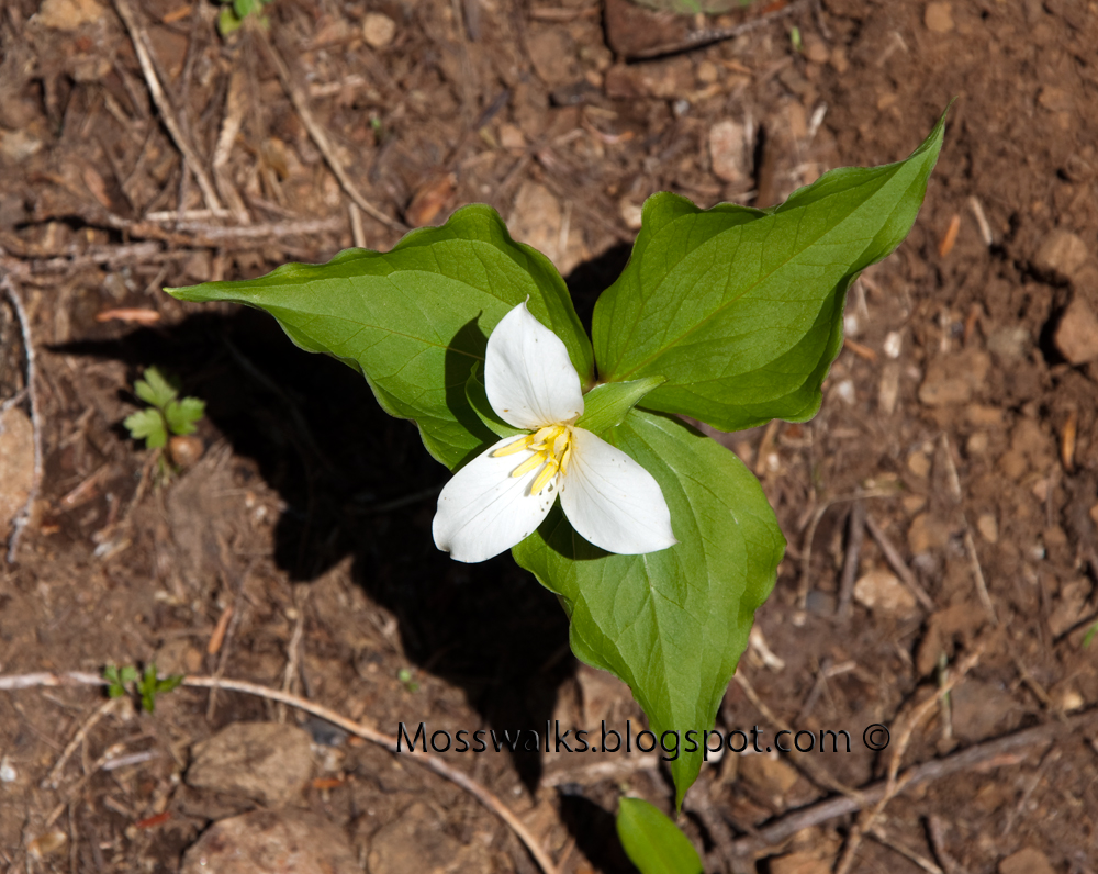
 |
| This plant lives off a type of mushroom |
 |
| Back down to Le Bar creek Patches cools her feet |
 |
| google earth track log |
 |
one way track log for the trip down
Elevation profile log for the trip down see how I gained over half the elevation in the last 1/2 mile |
Here are a few more pictures that I decided to add today:
 |
| wonder mountain wilderness pano |
 |
| snag on dry mountain look back towards the dry creek trail |
 |
| rock wall I had to skirt around to reach the summit |
 |
circle on left is near where I left the trail, line is my off trail route, circles on the right are the road I hiked up
About six miles with 2,000 feet elevation gain
|