Friday, January 25, 2008

South Mountain

Hike: H
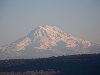
Sunrise behind Rainier


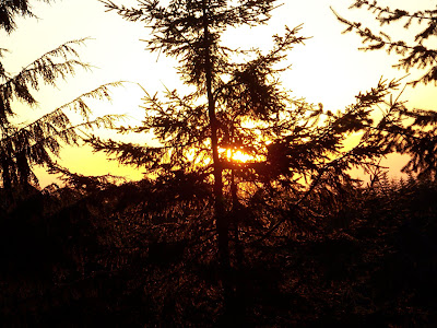
Sunrise behind small trees
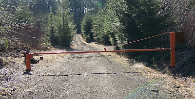

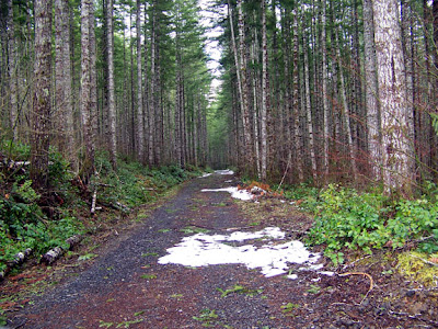
Snow free bottom gate


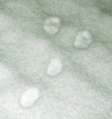
Animal tracks going up a hill


First test of my crampons


Glory Shot


West Summit View


Route to East Summit
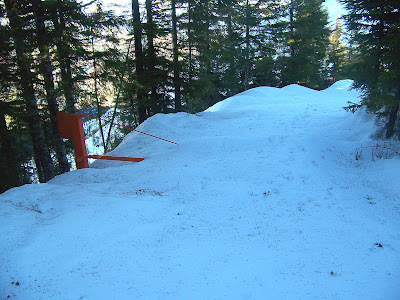


Snow-bound Upper Gate
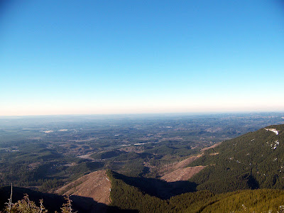

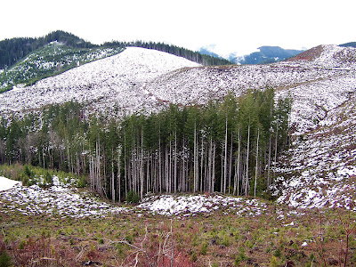
Old Sol Simpson Had a Farm E I E I Oooh
And on his farm he had a fellerbuncher E I E I Oooh
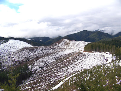
With a clear cut here, and a clear cut there, everywhere a clearcut...

South Mountain Jan '08

At 5:30 am my alarm clock woke me up, I felt like going back to sleep and thought about not going on my hike. I hit the snooze button but I got up before the alarm could go off again. I'm gaining weight and I need to go on a strenuous hike.

I stumbled around my house gathering up all my gear for the hike and making lunch. I made a thermos and a mug of tea. I needed to get an early start and hurry today so I could be back home by 2:00.

My hiking shoes have holes on the inside of both heels, I've hiked about 300 miles in these shoes and it is time to buy new ones. In order to avoid getting heel blisters from my worn out shoes I applied a bit of duct tape to both of my heels before I left the house. It took several minutes to defrost my vehicle; there was frost on both the inside and outside of my Jeep's windshield. Finally I was ready to leave! I drove about a block before realizing I had left my trekking poles behind. I knew I was going to need them today so back to the house I went.

I did not know if I would need snowshoes on the mountain top today. When I was standing on Grisdale Hill last Friday I could see a lot of snow on top of South Mountain. But I know that trucks drive up the road/trail in the winter. I would need some sort of traction if I was going to hike in tire tracks and my snowshoes have crampons but I really did not want to lug my snowshoes up the mountain. I took a risk and left the snowshoes behind and brought my un-tested crampons. If there was enough soft snow to warrant the use of snowshoes I would have no chance of making the summit anyway, I'm not in shape for an 8 mile snowshoe hike.

I won my crampons in a home made gear contest at the annual day zero pacific crest trail kick-off event in Lake Morena California. My entry was one of my home-made stoves with a home-made pot. The crampons are ultra-light and made to be used with running shoes instead of boots. Most long distance hikers do not wear boots. I'm not a long distance hiker but I don't own a pair of boots, I much prefer shoes.

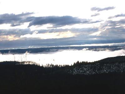
I drove to the 820 road in the dark. I only shared the road with logging trucks, I was hiking in logging country today. I started my hike at 6:50 am, it was dark but the moon was big and I could have found my way without my headlamp but I wore it anyway. I followed my moon shadow up the road. Shortly the sun began to rise behind Mount Rainier. The valley below me was still dark and I could see the lights and hear the sounds of nearby logging operations.

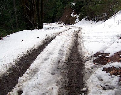
About one mile up the road patchy snow started to appear there were two sets of tracks from hikers who had gone up the road probably sometime last week. Eventually the entire road was snow covered and I began to slip back a tiny bit with each step. It was time to test out my crampons at last. The crampons were not necessary but they did make my hike less strenuous and perhaps a bit safer. For the first two miles I kept a pace of 2 MPH but after that I slowed down a bit. The road is graded for logging trucks for all but the last .10 of a mile. The last .10, the final slog to the summit, is a bit steeper.

In the dark I could hear pebbles falling down every cliff I passed. I had to wonder if an animal such as a cougar was up on the hill above me. Was there a cougar up there pacing me and waiting for the perfect moment to strike from above and behind? Cougars are most active and dawn and dusk and they say that you should never hike alone. BAH! What silly thoughts, still I clanked my trekking poles together a few times just to be safe. Animals tend to run away when I hit my trekking poles against each other.

Just before the summit was a new gate with a high RF warning sign on it. I don't know if the RF up here is something I need to worry about or not. I spend so little time on the summit that I think not. The tracks of the two people who had hiked up here last week stopped shortly past the sign, maybe the sign frightened them. The gate was buried by snow and I walked over the top of it.


I reached the summit in full daylight at 9:15 and the first order of business was to pull on my rain pants, a sweater, a hat and my raincoat. It was cold up there and I wanted to stay warm long enough to enjoy the view. Next I set up my kitten stove and pot and started heating up water for my tea. The water that was left in my water bottle after I poured out what I needed for my tea started to freeze almost instantly. Finally it was time to take pictures, drink my tea and soak up the view. The summit was covered with fresh snow and blocks of ice that had fallen off the repeater tower. I picked up a block of ice to bring home to my oldest daughter who loves icicles. The repeater tower had a fence all around it. The tower was not fenced off the last time I was up there. There was a lot of pollution in the air and my view was not as good as the last time, I could not see Mnt. St. Helens this time. I could however see the cooling towers for the never completed nuclear plants outside of Montesano.

I stayed for 45 minutes and headed back down the road at 9:45, I had plenty of time to hike down, maybe even enough time to grab a geocache on the way out.

On the way down it was light enough for me to see that pebbles were falling off of every cut bank above the road. I think the freeze / thaw cycle was causing the banks to erode.

I made it back out to the road by 11:15 and I hid a geocache near the parking area. I have a geocache and a terracache on the summit of South Mountain and I'm trying to encourage people to go find them. South Mountain makes for a fine winter hike; it has a fabulous view and enough elevation gain to make for a strenuous hike when the high country proper is snowed in. By going up South Mountain a few times in the winter I can hopefully stay in shape and be ready for the big hikes in the spring and summer.

On the way home I passed on finding the nearby cache that is owned by someone else, I missed my turn and did not feel like going back. I was tired from my hike and ready to go home. I felt good when I made it to the summit so I know I am not as out of shape as I had feared. Once I got home I put the icicle in my freezer to surprise my daughter with when she gets home from school.

To reach South Mountain take highway 101 to the Shelton-Matlock exit and turn towards Matlock. Just past a large saw mill is the entrance to the Simpson 800 line (an old rail road line converted to road) take the 800 line to the side road labeled 820 and turn right. Park near the gate (don't block it) and start hiking up.

GPS Coordinates for start of hike:
N 47*17.397
W 123*22.736


** Up **
Average Speed: 1.8 mi/h
Total Time: 02:04:57

** Down **
Average Speed: 2.5 mi/h
Total Time: 01:33:14

Over all average speed 2.14 MPH

Miles 7.75 Elevation gain 2,400 feet

 
Difficulty:
Hike:


A constant slow landslide
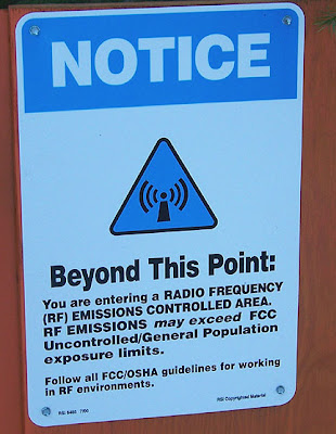


A new sign on the new upper gate
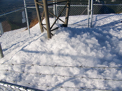


The tower is fenced in now


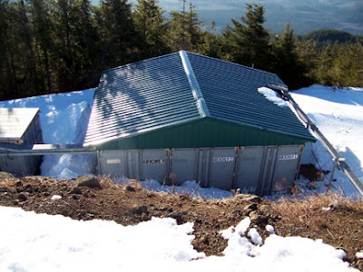
Repeater control house
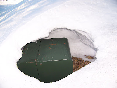

This box was humming
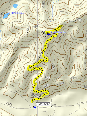

Track Log on Topo


Track Log on Google Earth
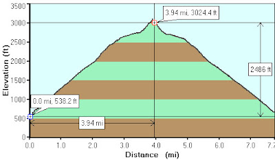

Elevation Profile Log

Tuesday, January 22, 2008

Crime and the National Forest on MLK Day


Sunrise on snow


We go to the National Forest whenever we can. I prefer going to the National Park but there are no nearby access points for Olympic National Park. Most of the access points are closed due to road washouts or landslides.

Twice this winter I have taken my kids up into the South Fork Skokomish area of the National Forest so they could play in the snow. I build a camp fire to keep warm by and we all roast hot dogs and marshmallows. One time we parked beside the road and today we parked in a campsite in the Brown Creek Campground.

We could not have reached this campground with out four wheel drive and snow tires. We had the entire campground to ourselves all day. We had a good time but only stayed for three hours because it got cold when the sun went below a nearby ridge.

We were not the first people to visit this campground since the snow fell. The campsite next to the one we used had been trashed. Diapers had been partially burned in the fire pit, beer cans were strewn everywhere and huge piles of dog poop were left behind. I don't know why people treat the national forest with such disrespect but I hesitate to come down on them too hard when I consider what the timber industry has done to the national forest. One trashed campsite does not compare to the clear-cutting of 90% of the Skokomish River Drainage.

Still I would like to see more law enforcement in the forest. In the past month I have witnessed trees being shot at, multiple piles of still smoking trash and dangerous driving. I have also noticed that the Fir Creek Guard Station was broken into this month. What gives? Has a lawless group suddenly decided to start using the forest this winter? Maybe this type of thing happens all the time but that's not been my experience. I am worried now when I park my vehicle at a trail head. I don't like the idea of unruly drunks with shotguns driving up and down the roads and shooting at trees just feet from my parked vehicle.

The Forest Service has only one law enforcement agent for all of the East Side of the Hood canal and he managed to find us when we were mushroom picking. He asked us what we were doing and if we were part of a group that was riding motorcycles too fast in the nearby woods. I don't like living in a police state so I don’t want to see the National Forest teaming with law enforcement but I'd like to see it patrolled a bit more.


Sunday, January 20, 2008

Grisdale Lookout


What a fun little hike this was with a great view at the top. I will do this one again.


You tube really degrades my videos but here is a 360 view from the summit.

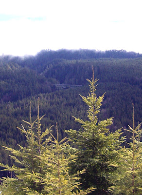
The view up here is awesome! You can look down to the Skokomish river and the High Steel Bridge and you can see Lake West from up here. There is a 360 unobstructed view of the surrounding peaks and I think you could see Seattle from here on a clear day. It was a bright sunny day and the snow was very crisp. I did not need my snow shoes.

Easy 4 mile round trip walk up a logging road with good views the entire way. I saw two deer up here and many tracks of deer, rabbit and fox. I will be back! I just home and I have a hikers high.

In the summer I could push a jogging stroller or ride a bike up to the cache.


This was 4 miles round trip with 870 feet elevation gain.

Parking coordinates are N*47.21.552 W*123.17.081


Going uphill:
** Speeds in ACTIVE LOG **
Average Speed: 1.8 mi/h
Total Time: 01:07:59


Elevation Profile


View on the way up


Trees in a stream buffer at the start of the walk.


Stream Buffer


Another view going up


Track Log


South Mountain telephoto lens view


View from summit


Looking down at the High Steel Bridge with 12X Zoom 


Looking down at Lake West


Wide angle view of the High Steel Bridge

Friday, January 18, 2008

Dow Mountain


Maybe Bunny Tracks


The lower road

I left my house at 6:15 am and arrived at the Big Creek trail head at 7:15 almost one hour before sunrise. A snow plow blocked off the winter time parking area with piles of snow too high to drive over so I parked on the road. I was a little bit anxious about hiking into the woods in the dark but the sun would be up soon enough. Too bad the first bridge is out, that was the end of my hike, over before it started. I wanted to go to the look out half way up Ellinor. I know the Big Creek trail is in bad shape and all the bridges are out but I thought I could get away with hiking up it to the Ellinor connector trail. I forgot about that bridge right at the start of the hike. Maybe I will cross the creek on the road next time and then bushwack to the trail.

So where to go? Every trail in the region is inaccessible it seems. Almost all the trails in the South Fork Skok are closed due to the wild life gates being shut for the winter. There is too much snow on the road to Spider Lake and too much snow to hike to Pine Lake. The North Fork trails are all closed due to the forest service deciding not to maintain the road to staircase in the winter. Too much snow to go up Ellinor, bridges out at Big Creek even the Hoodsport trail is closed due to storm damage. I thought about hiking up the road to Mount Ellinor but changed my mind when I saw all the snow on the road that leads to the road up.

Too much snow to drive to Lena Lake and there is a wash out on the road before the Putvin Trail. Probably too much snow to drive to Duckabush and how many years has the Dosewallips road been washed out now? It was beginning to look like Mount Walker was my only option but that is a long way to drive on a day when I have very little time to hike.

Then I remembered reading something about hiking up to Dow Mountain. A realtor at the bottom of the mountain helped me out by telling me that yes other people park at her office and hike up. But then she warned me about strange "protective" people living on the road up and asked me to let her know when I made it back so she would not have to call the Sheriff to rescue me.

So off I went up Dow Mountain not knowing how many miles it was to the summit, if I was going to get shot up there or if I would need my snowshoes. But my GPS came to the rescue. I had a topo map of the area loaded. With my GPS I knew how many miles I needed to walk and what roads to turn up.

I lugged my snowshoes all the way to the top but did not need them. I took them because I needed the exercise. I did not run into any strange people, in fact I saw no houses after the first ½ mile. The road that I walked up had no tire tracks on it. I was hoping for a view at the top. I was told you can see Seattle from up there but all I could see was trees. I saw a lot of animal tracks in the snow mostly small animals like raccoon, mouse and rabbit. At the top I ate my lunch and melted snow to make tea. My kitten stove is ok for melting snow.

7 miles round trip with 1,700 feet elevation gain and my legs are sore. I might be getting out of shape. Next week I will find another logging road to hike up. All the trails are gone but there is no shortage of logging roads.


The uppper road


The Summit and GPS


Racoon Tracks


The road


The summit

Wednesday, January 16, 2008

My Trees Were Spared


d
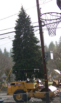
This summer the powers that be in the filthy little logging town I live in decided to turn the lot behind my house into an industrial yard. Since July we have been subjected to heavy machinery waking us up at 5:30 am. Up to 20 pieces of heavy machinery were parked just feet from our back door for months on end. They used to lot at a staging area for the city sewer project. In return the property owner got his two historical but derelict houses torn down for free. Sometimes they worked until midnight dumping chunks of concrete first onto the ground and then into dump trucks. The noise was awful and it was continuous. The machines made our house shake and sent fumes spewing into our yard. In the summer my new veggie garden was covered with dust. They would idle their equipment for up to 45 minutes at a time with the fumes going into our yard and house if we opened the door. One day I went out and turned off the machine in the above picture with out them noticing. We could not enjoy our back yard at all due to all the dust and noise. I regularly looked out my back window only to see workmen urinating on their tractors. They seemed oblivious to the fact that our house was there. My children were woken up to the sound of workmen cussing on several occasions.

Before the workers and machines came my oldest child used the lot as a play area. She called it her nature preserve. Her 3rd grade teacher was so impressed that she came to our house to take pictures of the "preserve". The preserve is now gone of course.

The heirloom apple tree that she hung bird feeders and bird houses in was the first casualty. Then the row of maple trees was removed, then the while lilac bush and the blackberry vines. I had to go elsewhere to get blackberries for pies, wine and jam this year. The workmen left two cedar trees, a pear tree and apple tree. They told me that all the remaining trees would be removed right before they left the site for good.

Well I'm happy to say that the 20 pieces of heavy machinery that were my view for the last 6 months are gone. I'm so happy to see them go. I'm also happy that they decided to spare the last remaining trees. I was prepared to go out and protest the removal of those last two cedar tree but I did not have to because they were spared!

Now when I look out my back window there is no grass and no heirloom apple tree and no black berries or lilacs so it does look quite barren and people can now look into our dining room from the main street in town. But also the 20 plus pieces of heavy machinery are gone and I have two cedar trees to look at.

All and all this was a horrible ordeal for us and I will never vote yes on any city project that might turn my back yard into a construction yard. I blame the city officials of backward and corrupt little town. They never never would have allowed a taxpayer to use a residential lot as a building site and parking lot for bull dozers.

Today my duaghter went out and played in her field and it made her happy.

Friday, January 11, 2008

Skok and stuck in the snow


The Trail Head


I tried to drive into Brown's Creek Campground today but my differential was bottoming out in the snow. I don't know if its a good idea to use a differential for a snow plow so I backed out. Then I got pretty stuck, could not go forward or backwards on the hill going out. Eventually I got out by putting a blanket behind one of my back tires. I was never really worried about getting stuck though. Now I know the limits of my snow tires anyway.

I hiked a little way down the Skok trail today. I only logged 4 miles but my legs are sore. Snowshoeing really takes it out of me. I used the flotation tails and my snowshoes worked a lot better but the tails made me very ungainly. I think I want different snowshoes. Mine are MSR Denali's with the longest (8 inch?) flotation tail.

I started at the main trail head and then hiked out to the road and then back to teh trail on the 120 access road when I returned to the trail I hiked about 1/2 mile down stream and had lunch before turning around. Than I hiked all the way out to the main trail head on the Le bar trail and the road. I wanted to do the 1 mile long Brown Creek Nature trail when I was done but it was not to be!


Track Log 3.9 miles


The turn around on the 120 access trail head


My tracks on the 120 road with flotation tails on


Sunshine on a winter day


A formidable barrier on the 120 trail


Snow at Sea Level too