Wednesday, January 13, 2016

Clear Lake - An underwater hike


Lake near a Christmas Tree farm


The weather forecast was miserable, up to 1.5 inches of rain and I was tired and grumpy.  I forced myself out the door at about 10pm and I headed up the Skokomish Valley.  There was  then minute delay for bridgework.  I turned off my car engine just in time for the flag to wave me on to go, so I started up my engine and the flagger immediately switched the sign to stop.  It was just one of those days.

As I drove up the valley it dawned on me that the Skokomish river was probably going to flood and I would not be able to drive out the way I came in.  I had about 1/8th of a tank of gas, so maybe that would be enough to get me out via the evacuation route.  I was tailgated and there were log trucks passing in the other direction.  I drove down a road that was too bumpy for my car, I remembered my Jeep getting a flat tire on the same road.  I had not planned on driving the road but there was so much traffic that hiking it did not appeal.  I got to the end of the road and prepared to hike in a foul mood.  Then I discovered that the little trickle that I cross to get to the other side was a raging creek.  Okay that was enough, I did not want to get trapped up there in a flood and I did not want to wade in up to my neck.  I decided to cancel my hike.

During the drive out I remembered the little lakes north of town that I had been looking at on Google earth.  I had yet to visit them because doing so would not be a real hike.  I was saving it as a in between hikes hike.  But today it would be my only chance to hike so I went for it.

I enjoyed exploring the maze and old and new roads.  I obeyed all the posted signs but I still might have been in places where I was not allowed.  It was hard to tell.  I did my best to obey the law.  I found the that little lakes on Google Earth were quite large and beautiful.

I pitched my tarp for lunch at Clear Lake.  The rain was really pounding down, but no worries under my magical cuben fiber tarp.  I sat under my tarp and sipped hot coffee and ate cheese and crackers with my buddy Patches.  Life was good!

For my coffee I used water that I had funneled from my tarp.  I won't even drink filtered water this close to Shelton.  Shelton has at least two big open toxic waste sites that the city won't close.  One of them is a Lake and the other is a landfill.  The city also just recently turned down grants to find out about other sources of pollution!  With so much pollution known and unknown I won't be drinking any surface water in Shelton.

After lunch I poked around and found a few more lakes and I was turned back by a flooded road.  Patches wandered back a bit to sniff out a carcass and the next thing I knew she was leaving me.  I called her back but she did not hear me, she is getting deaf, I think.

Well she always finds me and it was getting late so I started to find my way out.  But Patches never did catch up.  I went back to where I lost saw her and wondered what to do.  Would I stay there in the dark in this strange place and risk getting lost getting out?  Sunset was just on half hour away.  I doubted that Patches would survive there overnight if she got lost.  She had been shivering a little bit at lunch time in spite of having two thin dog coats on.  I walked around in circles for  bit to keep warm while trying to decide what to do.  Patches had never done this before.  Is she getting senile?

Suddenly Patches appeared where I had last seen her and she seemed happy to find me.  On the hike out she wandered off a bit but I forced her to stay close.  I've never had to worry about Patches not staying with me before.  I think she is losing some of her common sense along with her hearing and her sight.

I'm going to have to start treating her more like a normal dog and less like the super hero hiker that I know she really is.

6.5 miles with 150 feet elevation gain

I'll go back on a dry day and take some nice pictures.   I only had my waterproof point and shoot camera for this underwater hike.


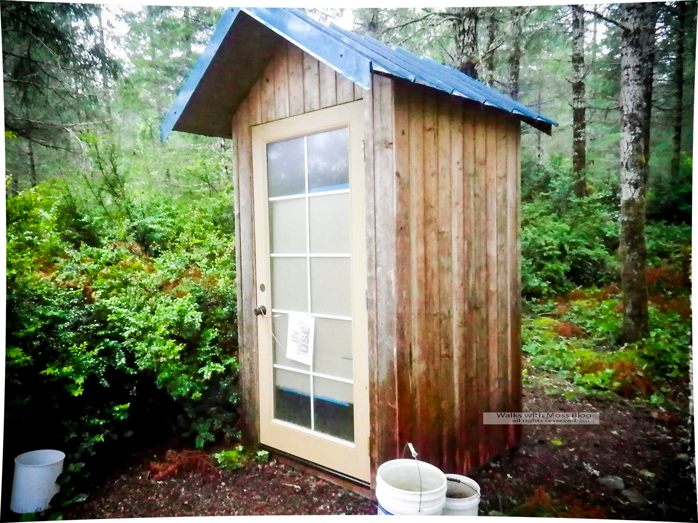
A ten minute delay in each direction


underwater 


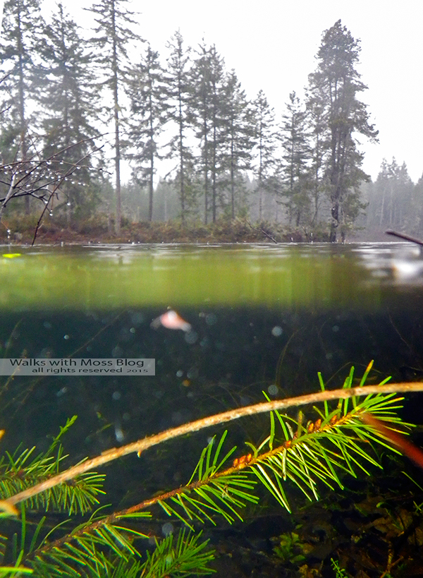
Half underwater half above, both just as wet


A black hole of biodiversity


Under a mudpuddle

Nice set up.  It was not posted.


Monday, January 11, 2016

Haven Lake


Haven Lake

A gate is closed preventing access to South Mountain. The road is also red dotted.  So we went to Haven Lake instead.

 did not have my gps as I was planning on a straight forward hike up South.  I found the lake just fine without my gps and on a slightly different route than usual.

I could see a lot of people down on the Vance Creek Bridge.  I'm glad that I got to see the bridge before it was popularized on the Internet by folks who are out to make a buck.

There was shallow crusty snow for most of the route.

We saw bobcat tracks and Patches ate a lot of bob cat poop.  She refused to eat the dry dog food I packed for her. She much preferred to eat wildcat poop.

6 miles with 450 feet elevation gain

It would have been under six but I did some backtracking after I found my hiking partner who was hiking in as I was hiking out.

Bob cat tracks
The days are getting longer and we made it out before dark

Fog covers half of the Skokomish Valley


The Vance Creek Bridge was crowded

Phil brought his ultralight stove

I found a shelf fungus to set my coffee cup on


Saturday, January 9, 2016

Pyramid Hill


A late start for this hike thanks to being given a last minute photo job.  Hit the trail at 10:30 and knew there was a need for speed.  Did 3 mph for the first hour to make up for lost time.  After the first hour the pace was more relaxed.

We climbed up a knob that is sort of attached to Buck Mountain.  The view on top of  Buck Mountain at the old look out site is totally obliterated by trees.  This little knob has been recently clear cut and a view of Price Lake seemed likely.

The road circles around the knob and the top of the knob as a few trees, but the view was from the road.  As we climbed up the road the views became impressive.  It looked like Lake Cushman, but soon it became clear that we were being treated to a sweeping view of the Hood Canal and Quilcene.  A view of the Hood Canal had not even been anticipated.  The view was grand!  All up and down the Hood Canal and over to the Cascades.  The Seattle skyline was not in view either due to fog or due to being blocked by Gold and Green Mountains.

Lunch was coffee and cheese and crackers, I also had 5 candy canes during the hike and that was it for my food.  It was  very light eating for me, but Patches enjoyed three peanut flavored power bars.  They can sometimes be purchased four for a dollar when they are expired; they are Power Bar brand bars.  Patches hates Clif bars but she will gobble up the Power Bar brand bars as long as they are not too cold for her to chew.

We headed back down the mountain and then cut into the woods for a brush crashing adventure.  We saved at least mile by brush crashing to the next road on the itinerary   There was a route to the lake that needed to be checked out.  At one point on the route a big rotten log fell onto patches back as she was going under it and she let out quite a yelp.  Was her let broken?  Nope, she was fine.  That was a close call though.

We made our way down to the lake on an off trail route.  The going was hard on me since we were quite tired and time was running short and hunger was setting in along with a foul mood.   We found a little bit of a shoreline but we did not stop for coffee.

A truck and drove up and down the road while we were up on Buck Mountain.  The truck left fresh tracks and broken ice.

We made it back to the gate at 5pm just as it was getting dark.  Patches went under the gate.  The gate swung open under my weight and took me for a ride.  What?  The gate was supposed to be shut and locked for the season.  The gate would not stay shut and the hour was late and exhaustion had set in, so the gate was left open.  

An email was sent to the DNR to let them know about the situation.

My goal was to get through this entire blog post without using the word “I”.


10.5 miles with 850 feet elevation gain


Looking down on Quilcene


Tuesday, January 5, 2016

South Mountain


M0unti@n Li0n Tr@ck


9.75 miles with 1,000 feet elevation gain.

Monday, January 4, 2016

First Hike of the New Year


This hike is a secret because I saw bear and cougar tracks.

Bear

Bear

Cougar

Ice

Unknown

10.5 miles with 200 feet elevation gain