 |
| Train ticket from Featherston to Upper Hut |
Tutuwia Hut
Backpack Trip
My trip to
New Zealand was more about visiting a friend and just getting away while I
could line up care for my kid, dog, chickens and fish. I did not expect to do any overnight
backpacking trips and I was staying on the North Island.
Looking at
the map where my friend lives, I looked up a few hiking trails with an eye
towards day hiking. On the map I could
see that the trails had huts on them.
Further research indicated that the huts were heated!
Heated huts
in the winter? This changed all of my
plans! I switched from trying to pack just a carry on bag to packing my largest
suitcase, so I could bring my overnight gear.
I needed
boots for the mud, my down quilt, my backpack and some other gear for a comfortable
overnighter. I opted to bring my
handmade dayhiking pack since it is smaller and I was only going out for one
night. My dayhiking pack does not have a
hip belt but that would be okay since I only had to carry one days worth of
food and did not need to carry a shelter.
To start my
journey I walked one mile (1.6km) to the Featherston train station and I took
the train to the town of Upper Hutt, where my friends parents were waiting to
give me a ride to the trailhead. Thanks so much for the ride!
I started my
hike at Kaitoke off of Marchant road and highway two at the Kiwi Ranch
trailhead. My goal was to make it to the
Tutuwai hut in the 8 hours of daylight that I had. The track starts out by going up a hill with
some views of farmland before it dives into the woods and goes up another hill
and then drops down to Smith Shelter and
the Tauherenikau river.
Pronounced (tear a knee cow). The trail then follows the river upstream to
the Tutuwai hut and beyond.
At the
halfway point on my hike I experienced my first swing bridge and it was scary,
but I was too far in to turn back, so I went for it.
The trail
was very well marked with lots of nice new looking metal signs. After crossing the bridge though the trail
turned into a "tramping path" and I had to pay attention to stay on
the trail in a few spots.
I made it to
the hut at 3pm and the sun set at around 5, so I made it in plenty of
time. The hike was a bit rushed for me
because I was racing the sunset and I am a slow hiker. Even racing the sunset I did not travel
anywhere near as fast as the signs indicated.
They like to measure trail length in hours instead of distance. I guess that is fine if you are a long legged
20 year old and not a short middle aged photographer.
I'd rather
know the distance and the elevation gain thank you very much.
The hut was
nice and there was a little bit of wood left, so I did not freeze in the night
like I normally do when I go backpacking.
The hut cost me 3 hut tickets ($15NZ) that I purchased at the DOC office in
Wellington. They were very friendly and
helpful in the DOC office but they refused to tell me how many kilometers long
any of the trails were. I was glad that
I had downloaded a free NZ topo map for my phone that I could use to measure
the distance and elevation gain.
In the
morning I packed up and ate breakfast in the dark anticipating my long hike out
and another race against the setting sun. I used my Delorme satellite messenger
to let my friend keep tabs on where I was and to send messages with my ETA back
to the trail head.
On the way
out I made a wrong turn that cost me about 400 feet or 120 meters, in elevation
gain before I figured it out and turned around.
I had a
great hike and I hope to go back and explore New Zealand and spend more time
with my friend soon.
27
Kilometers with 518m total elevation gain round trip
17 miles
with 1,700 feet total elevation gain
 |
| Train pulled into the Featherston Station |
 |
| Trail head sign |
 |
| Trail sign right near the start |
 |
| Native toe toe grass |
 |
| Unknown to me fruit |
 |
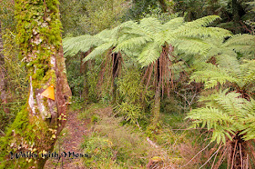
| Tree Ferns, so amazing |
 |
| Mystery Lichen |
 |
| Mystery Lichen |
 |
| Mystery Liverwort |
 |
| Mystery plant, a fern I think |
 |
| Amazing tree ferns |
 |
| Cable to help with river crossing was so nice! |
 |
| Swing bridge over the Tauherenikau River |
 |
| Tauherenikau River |
 |
| Mystery lichen |
 |
| Tea break on the river |
 |
| Tauherenikau River |
 |
| Mystery lichen |
 |
| The trail in an open area |
 |
| Tutuwai cabin stove and wood |
 |
| Tutuwai hut sleeping area |
 |
| Nice toasty fire |
 |
| Tutuwai Hut |
 |
| Mystery fungi |
 |
| Glossy leaved plant |
 |
| Big lichen |
 |
| Tauherenikau River in the morning |
 |
| Fungi on a leaf |
 |
| Rope to help in steep spot |
 |
| Liverwort |
 |
| Amping up before going up the final hill |
 |
| Slippery track at the end of my hike |
 |
| Parking area |


