Pages

Friday, January 31, 2014

Mount Rose during the drought of 2014


To cold to linger on the summit today
Again I was feeling much unmotivated; I just did not want to get out of bed.  But I did want to get in at least 4 good hikes in January and today would be my last chance.  I drug myself out of bed and fiddled around with my pack a bit.  Then I jumped on the internet and thought about just staying home and playing on my computer.  But Patches knew I was preparing to hike and she was so excited.  Patches enthusiasm to hike is what finally got me moving.  I thought about doing Marmot pass, but in the end I settled on boring old Mount Rose.

I started hiking in light rain.  Two other hikers were on the trail ahead of me.  They were wearing blue jeans and only had one tiny pack between the two of them.  Another hiker passed me just at the wilderness boundary; he also had a small pack but was probably much better prepared.  Maybe one day in the summer I will run up and down Mount Rose with nothing more than a water bottle.  I don’t think it’s a good idea to climb Mount Rose in February without packing extra clothes, rain gear a head lamp and a first aid kit. 

It took me three hours to reach the summit and I was kicking myself a bit for being so slow and wondering if I could ever do a through hike of the PCT as slow as I am.  I would love the hike the PCT and the AT when my daughter is younger.  In all of the times I have hiked up Rose I have never once passed anyone.  EVERYONE is faster than me EVERYONE!

The summit rock was wet and cold and slippery.  Snow was blowing sideways too.   I opted to have my lunch at the little ridgetop meadow rather than on the summit.  If I had waited a bit I might have gotten a good view from the summit as the sun came out while I was having lunch on the ridge. 

I’d say that about a quarter of an inch of snow fell while I was hiking.  The ridge was mostly bare of snow.  Normally this time of year the ridge has so much snow on it that I can’t even guess at its depth.  This is such a strange year!

Lunch on the ridge today was one Luna bar, one orange and a cup of hot instant coffee.  Patches had her very last TurboPUP bar for lunch.  Patches won a weekend supply of TurboPUP bars as her prize for being TuboPUP of the month in December.  She really liked her bars; I hope I can buy her some more in the future.

I took my time hiking down since I was tired and sore and my boots are just tight enough to make my big toes hurt on the down hills.  It actually took me more time to hike down than it took me to hike up.  I took a lot of pictures on my way down.  To save weight I packed just my 50mm 1.8 prime lens.  I would really rather has a 35mm prime lens.  50mm is just too much zoom for me with my crop sensor camera. I’m hoping to find someone who wants to trade lenses. 

When I pack just my little prime lens I can wear my camera over my neck and shoulder because it is so light and does not suffer from zoom creep.  My normal hiking lens is the Nikon 18-200mm; it is heavy and has terrible zoom creep so I have to carry my camera in a holster when I hike with it.
At horse camp I took a 20 mintue break with my feet up and I ate a banana.  After horse camp I quicked my pace and I made it back down to the trail head at about 4:30

I reached the trail register just in time to see a forest or park ranger slam on their brakes down on the causeway road and then sit there for a moment or two.  I have no idea what that was about.  Was he watching me or was he watching the lake?
Light snow near the summit

Lichen or fungi?

Shouler of either Mount Ellinor or Mount Pershing

Taken with my puppy portrait lens

No snow at 4,200 feet!

on the summit some snowflakes land on my pants


Moss sporophytes with the light hitting them just right


One hour rock.  It took me one hour and 8 minutes to reach
One hour rock today.  That's my slowest time I started keeping
track last year.

Just a dusting of snow near the top

Snow sparkles in the sun


Yay for wilderness!

Wednesday, January 29, 2014

Staircase Rapids Loop

The lichen Usnea longissima hangs from a Neckera covered Maple tree (Acer macrophyllum)
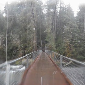
My daughter's school had the day off so I had to scale back my plans a little bit.  I took her and a friend to the Staircase Rapids Loop Trail.  The new bridge is really amazing.

It rained for most of our hike but the skies turned blue at the end of our hike and we enjoyed tea time at a mostly dry picnic table after our hike.  We saw four other people up there today.

It's the end of the month and I was able to stick to my budget really well, so I bought myself a new backpack today.  It is a ULA brand Circuit.  I will use it for backpacking trips and  I will retire my Gorill@ pack to day trips only, but first I'm going to make some modifications to it.  I intend to get rid of the clips on the top and turn my pack into a roll top.  I will lose the top pocket by doing that though..

2.5 miles 300 feet elevation gain 200 calories


Little Red Riding Hood's Grandma (?) enjoys the new bridge.
Watch out for the big bad wolf.

Crossing a smaller creek in the rain

Friday, January 24, 2014

Fir Lake


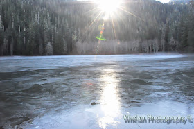
The washed out road to Fir Lake was converted to trail and it's pretty ugly now, but it is really easy to bike on with all the alder trees gone.  Maybe it won't be so ugly in a few years.  Normally in January it is buried in snow, but this is such a strange year.  There is no snow at all at Fir Lake and I could not see any snow on 3,900 foot tall Chapel peak.

I opted to take my bike since the trail is too ugly to hike down right now and since there is no snow.  This hike is just 4 miles in the summer when the wild life gate is open.  In the winter it is a 9 mile hike and normally requires snow shoes.

I started my hike at 10:10 and I knew that a friend might be behind me.  I did not want to wait for him to pack so I took off earlier and we went in separate cars.  I did not know for sure that he was coming until he caught up with me.

I decided to follow the old road down to the outlet for the first time ever.  Before I had always followed the old road up to the inlet.  By taking outlet route I was able to get the the lake faster.  I parked my bike on the trail and walked down to the lake on the old road bed.

When I reached the lake I saw that the only way to get sun would be to cross over the outlet or inlet stream and get to the other side.  I opted to cross the outlet but it was a bit scary.  I had to cross on ice covered logs and I did not have my trekking poles. It was a bit dicey, it was scary but it seemed doable.  Too bad I had a total 180 degree Diva  failure right in the middle.  That is always quite dramatic, but there was nothing I could do about it while standing on an ice covered log in the middle of the creek.

I am so done with being a diva!

It was so sunny and nice on the far shore, my friend and I enjoyed a long lunch together and I brewed coffee for both of us.  Then the sun went down and it got real cold real fast, so we packed up and left.

Video trip report here:
***************
***************

When I was recrossing over the log jam one log broke off under my feet and I got both of my feet wet.  Then Patches got stuck with her back half under water and her front paws up on a log.  She whined for me to come get her.  Great.. I really did not want to go back out onto those icy logs, but I also did not want Patches to die there.   So I took of my pack and my camera and headed out to save her. As luck would have it, she saved herself just as I was starting to climb out onto the logs; I did not have to risk getting wet again.

Riding back down the new "trail" was fun, it was all down hill and it was so smooth.  It's a nice butt ugly new trail, with a good surface, I don't totally hate it anymore.  A bad ass mountain biker could have a blast bombing down it, but I had to go slow because Patches was running behind me and I'm not a bad ass mountain biker.

We got back to the wild life gate at 4:30.  I'm glad that the days are getting longer now and giving me more time to hike.

9 miles RT with 800 feet elevation gain.  

I will only count 4.5 of these miles as hiking miles in my calculations.


Algae or aquatic liverwort?


This is what the road looked like before it was converted to "trail"


Tuesday, January 14, 2014

Walker Mountain and the bus ride from hell


We took the bus, this time I convinced a friend to ride the bus with me.   People who own cars can be very nervous about riding the bus and my friend was nervous.  We boarded the bus at the Shelton transit center at 8:05am and began our trip up the Hood Canal.  The bus ride up the Hood Canal is usually wonderful; I had told my friend about all the wild life we would see along the way.
Too bad this trip was nothing like I had promised.  This trip turned out to be the bus ride from hell.  Okay, not quite hell for me, but only because I’ve rode buses in  third world countries.  It was certainly hell by  North American standards. 

 The driver kept going over the center line on highway 101, and I don’t mean just once or twice.  No, she went over the center line at least once a mile.  It was a 40 mile bus ride, so that means she went over the center line at least 40 times.  She crossed the center line right in front of a logging truck at one point.  But that’s not all; she also crept up onto the same car and then suddenly slammed on the brakes to keep from rear ending the car several times.  She also took her eyes of the road and drove with one hand while she fiddled with her purse.  

 Her driving was so bad that I and my friend both felt like we were going to throw up and Patches did throw up.  I felt like I was on a rollercoaster ride, except for that fact that it was not fun.  I love roller coaster rides, but I could not wait for this bus ride to end.

When we got to Brinnon and everyone was off the bus, the bus driver rushed into the outhouse.  Perhaps she had made herself nauseous too.

My poor friend who has not been on a bus in ages and had nothing to compare this too, thought this is what bus rides were supposed to be like.  When we transferred to the Jefferson Transit bus in Brinnon  he found out that not all bus rides are the same.  The Jefferson Transit ride was nice and smooth, the driver was good.  It was a normal bus ride.  My friend was much relieved that the second bus ride was not the same as that hellish never ending ride to Brinnon.

Our pleasant ride back to Brinnon
 

We got off of the Jefferson Transit bus at Walker Mountain antiques and walked up  to the gated entrance to Walker Mountain.  There we saw two car loads of happy chatty hikers preparing to take off up the mountain.  It was then that I remembered the Monday Hikers were to be here today. 

This was a problem because I wanted to let Patches run off leash.  I inquired of the group of hikers and they confirmed that yes, they were the Monday hikers (the hiker division, not the mountain goat division)  and another car load was on the way.  They seemed like a very nice group of people and I did not want to inflict my dog upon them, so we opted to turn back and hike up the Elbow Creek trail instead.
The hike was nice and quiet and uneventful .  I found some patchy snow at 2,900 feet.  We got a nice workout and Patches got to run free without disturbing anyone.
The bus ride home on Mason Transit was nice and smooth just like it should be.  The driver never once went over the center line or took her eyes of the road or tailgated.  The driver even pulled over one time to get some distance between her bus and a car that had a wobbly tire.  She was a good defensive driver.   

I’m not sure what to do about my bus ride from hell.  That first driver should not be on the road, but turning her in could make me all kinds of enemies in this small town.  Then again, how will I feel if she drives head on into a school bus and kills a bunch of people?  She needs to retire; I hope that someone else notices  before it’s too late.

Update: I've decided to do nothing.  Maybe the driver was just having a bad day?

5.5 miles with 2,950 elevation gain, 1,279 calories burned
Calories burned is based on http://hikingscience.blogspot.com/p/calculate-calories-burned_22.html

Track and elevation log including getting off the bus
and backtracking to elbo creek

Fording the mighty river

Time for a drink

Moss is the only water filter I use

Lichens and moss

Looks like a white fungi is taking over this peltigera lichen

My friend hanging on for dear life, expecting this ride to be the same
(this was one of the nice rides, so there was no need)

Patches hydrates at 2,800 feet

I want to come back and camp here

The forest on the ridge
 

Thursday, January 9, 2014

Kicking off 2014 North Fork Skok (Staircase) to Big Log


wet, dark, cold and fun
On Monday I went to the dentist and got all the filth and rot drilled and hammered and sucked out of my tooth. (tooth number seven in dental parlance)  Getting rid of all that infection did the trick!  After suffering since late November with a tooth infection concurrent with  the worst sinus infection I have ever had in my life, I am finally well again.  Wow,  a rotten tooth can make a person feel sick, even when it's not causing any pain.

I got that tooth filled six months ago and within a week of it being filled, I noticed it was turning brown.  Dental work leads to more dental work.  This is the second time in my life that I have lost a tooth right after it was filled.  I believe that my dentist damaged my tooth when he filled it.  This time around I'm getting it fixed.

 Last time I was just a kid and my Dad, even though he was a GS 13 in the federal government was too cheap to pay for a root canal (tooth number 3).  He had the dentist pull my tooth.

 Anyway, to the hike, for this hike I got a rather alpine start at 10:45 am.. okay that's not an alpine start at all. I woke up late because I was so groggy from all the pills I had to take in order to sleep.  Hiking cures my sleeping troubles, but I had not been hiking much at all recently so the only way I could sleep was with a good dose of alprasolam.  Oh also I'm being harassed by Social Security to cough up all of my pay stubs from 1998 to 2002 . As if I would actually have those!  I dont' know about you, but being harassed by the Feds always gives me insomnia.

So I woke up groggy and got off to a late start. I decided to stop for coffee in Hoodsport and Marcus just happened to be on duty.  He told me he got banned from northwest hikers net and an unrelated facebook page.  Poor Marcus, he's a good person and both his parents just died. 

So what if he is a bit irritating at times.  I'd be way more that just a bit irritating if I had good supportive parents in my life and then they suddenly both died within two months of each other.  Northwest hikers net used to be a busy interesting place, then it got slow and boring.  Then Marcus came along and spiced it up a bit.  Now it's boring again.

So anyway, I hit the trail at 10:45 am and Big Log camp was my goal.  I used to hike to Big Log all the time before I got Patches.  It's not a very exciting hike, but I missed seeing the sheltering hallowed out cedar tree that is in the campsite there.  I decide to start out on the four stream trail so I could walk over the new bridge.  The bridge was replaced about 8 months ago, but I still had not crossed it.  I tend to avoid staircase for many reasons, including crowds, rangers and that Patches is not allowed to hike there.

I thought I had 10 miles to hike and 5 hours to do it, so 2mph would be a good pace if I wanted to get out before dark.  I got to Big Log and had my tarp set up and was ready for lunch about 3 hours into my hike.  I was behind schedule, if I wanted a one hour lunch break and I did.  So, I stayed and had lunch in the pouring rain for about and hour knowing that the cost would be hiking out in the dark.

It was cold and my hands got cold while I was setting up my tarp so I cooked up a hot lunch to go with my usual hot tea.  I was comfortable sitting under my tarp drinking hot tea and eating hot lunch. Hot lunch was a home dehydrated meal of rice, lentils some veggies, some wild mushrooms and a tiny bit of unidentifiable meat.  I also ate three pepperoni sticks, some mixed nuts and two expired Titan brand protein cookies.

I'm not sure why I ate so much, perhaps because I did not eat anything on a the way in.  Eating that much for lunch gave me a slight tummy ache and my tummy was already upset from taking fourt rounds of antibiotics for my tooth and my sinuses.

At about 3pm I started my hike back out knowing that was about 6 miles from my car and the sun was going to set in an hour and a half.  I opted not to cross the bridge on the way out and instead made a little loop by taking the NOFO Skok trail back to my car.

When I got back to my car it was very dark and I could not see any lights coming from any of the Ranger buildings.  Perhaps the entire place was vacant on this night, but I thought that someone lived out there in the winter now.  There was a giant roll of toilet paper in the out house. It was too big to fit on the square roller and was rather difficult to use.  Maybe a ranger had left the gaint roll there before they went on vacation?

It rained all day and my arms, legs and shoulders got wet, but my feet were perfectly dry in my newish waterproof hiking boots.  I thought that my jacket leaked and that really disappointed me, but now I think it was just water coming in from around my head since I did not wear the rain jacket hood.

 Instead of wearing the rain jacket hood I wore my Seattle Sombrero.  The Sombrero is much more comfortable to wear as it does not block my vision or cover up my ears.  There was a price to pay for that comfort, the price was wet shoulders and arms after 6 hours of hiking in the rain.

Inside one of my favorite trees with my Seattle Sombrero on


I stopped at Hoodsport on the way home, this time for a hot chocolate.  I started shivering when I was in the store, but I warmed up again when I got back into my car.   That hot chocolate sure when down easy..

I did not bring my big camera with so much rain in the forecast and my lens was never dry, so my pictures are not very good.

11.75 miles with about 800 feet elevation gain.
1,400 calories burned (roughly)


The start

North Fork Skok


New Staircase Rapids Loop Bridge


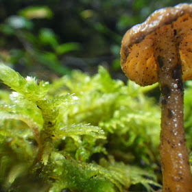
Tiny mushroom with Rhytidiadelphus loreus moss

My refuge at lunch time

Hot lunch under the tarp
The SPOT message I sent from here
never did send even though the unit said
that it did get sent and it had a satellite lock

My view at lunch time

"devils matchstick" Philoporus acicularis lichen

It tasted bitter, I think it's agarikon

Now that I'm off antibiotics, my next hike should go better.